Image:John Speed's map of Oxford, 1605..jpg
From Wikipedia, the free encyclopedia

No higher resolution available.
John_Speed's_map_of_Oxford,_1605..jpg (597 × 476 pixels, file size: 159 KB, MIME type: image/jpeg)
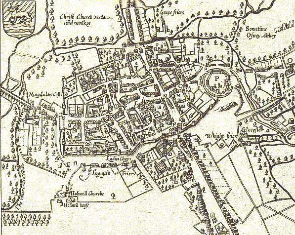
1605 map of central Oxford, England, by John Speed. Note that south is at the top of the map.
File history
Click on a date/time to view the file as it appeared at that time.
| Date/Time | Dimensions | User | Comment | |
|---|---|---|---|---|
| current | 08:02, 15 August 2005 | 597×476 (159 KB) | ¡0-8-15! | (John Speed's map of Oxford, 1605. North is at the bottom. Oxford is still a walled city, but there some buildings are outside the walls, including Magdalen College. "P" is Oxford Castle. "N" is Oxford's central crossroads at the junction of the High S) |
File links
The following pages on Schools Wikipedia link to this image (list may be incomplete):
Metadata
This file contains additional information, probably added from the digital camera or scanner used to create or digitize it. If the file has been modified from its original state, some details may not fully reflect the modified file.
| Software used | Adobe Photoshop Album 2.0 |
|---|---|
| File change date and time | 08:48, 13 May 2005 |
| Y and C positioning | 1 |
| Colour space | sRGB |
Categories: Images of Oxford | Geography of Oxford | History of Oxford
