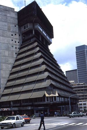
Abidjan
2008/9 Schools Wikipedia Selection. Related subjects: Africa; Cities
| Abidjan District d'Abidjan |
|||
| — District — | |||
| District of Abidjan | |||
|
|||
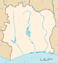
| Location within Côte d'Ivoire, French West Africa | |||
| Coordinates: | |||
|---|---|---|---|
| Country | |||
| Region | Lagunes | ||
| Subdivisions |
List
|
||
| Government | |||
| - District Governor | Pierre Djédji Amondji (since 2002) ( FPI)) | ||
| Area | |||
| - Total | 2,119 km² (818.2 sq mi) | ||
| Population (1998 census) | |||
| - Total | 3,125,890 | ||
| - Density | 1,475.2/km² (3,820.7/sq mi) | ||
| (2003 est) Pop: 3,660,682 (2003 est) Density: 1,728/km² (4,475/sq mi) |
|||
| Time zone | GMT ( UTC+0) | ||
| Website: www.abidjan-da.ci | |||
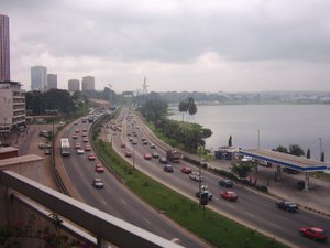
Abidjan is the largest city and former capital of Côte d'Ivoire (Ivory Coast). It is the commercial and banking centre of Côte d'Ivoire as well as the de facto capital (Yamoussoukro is the official capital.) It is also the most populated city in French-speaking Western Africa. It stands in Ébrié Lagoon on several converging peninsulas and islands, connected by bridges.
Origin
According to an Ebrié legend, the name Abidjan (formerly Abijean) came from a misunderstanding. An old man, returning from his field with an armful of branches that he probably intended to use to repair the roof of his house, happened to encounter a lost European explorer who asked him the name of the nearest village. Unable to speak the white man's language, the old man believed he had been asked what he was doing there. Fleeing in terror from this unexpected encounter, the old man shouted: "tchan me bidjan" which in the Ebrié language means "I've just been cutting branches!" The white man took this to be the answer to his question and conscientiously noted the name "Abidjan".
History
Abidjan was the third city to be the capital of Côte d'Ivoire, after Grand-Bassam and Bingerville, which is now considered to form a suburb of the current capital. Its populace, the Tchaman, were renamed ébrié, derived from the "quolibet" given to the lagoon pirates by the inhabitants of Grand-Bassam. As such, in their language, ébrié means "salty/dirty skin".
Under the direction of engineer, Houidaille, Bingerville was created in 1899. Following an epidemic of Yellow Fever, the colonies of Grand-Bassam decided to relocate here because of its healthy atmosphere. This was also when the Colonial government started its relocation to the remote village of Adjamé, which would come to be named Bingerville after the first governor of the colonies, Louis-Gustave Binger.
The future Abidjan, nearby, also situated by the Lagune n'doupé (Lagoon of Warm Waters, the future ébrié Lagoon) offered more space and greater possibilities for commercial expansion. The Petit-Bassam Wharf, the current Port Bouët, south of the metropolitan area, grew rapidly in competition with the Grand-Bissam Wharf, until then the principal economic gateway for the colony. In 1904, when Bingerville had not yet been completed, Abidjan became the principal economic pillar of the Côte d'Ivoire colonies, a primary relay point for distribution of European goods further inland, notably by an increasingly important Lebanese community.
On 10 August 1933, a decree was passed, moving the capital from Bingerville to Abidjan (or Abidjean), displacing many tchaman villages, which moved mostly to Adjame, the 'confluence" or "centre" for tchaman, located north of the Plateau and which again became the chief tchaman community. It is here that the community lost the "Sacred Drum" (A very characteristic drum which is currently in the possession of the Musée de l'Homme - the Museum of Man) as currency of blackmail, to force Tchaman participation in the construction of the Abidjan-Niger Railway system.
South of the Plateau District, currently the central district of the abidjan metropolitan area, the village of Dugbeyo was moved to the other side of the Lagoon, in Anoumabo, "the forest of the dogfish", which would later become the district of Treichville in 1934, renamed in honour of Marcel Treich-Laplène (1860-1890), the first explorer of Côte d'Ivoire and its first colonial administrator, considered its founder. Where Dugbeyo once stood, today the Avenue Treich-Laplène serves as the main bus and ferry terminal, and is also the location of Avenue Charles de Gaulle, commonly called Commercial street.
The city is designed along the usual colonial guidelines, on the basis of rather Utopian town-planning. The colonists inhabit The Plateau ("m'brato" in the Tchaman language) while the colonized people live in the north. The two zones were separated by the Gallieni Military Barracks, where the current Law Courts are located.
In 1931, the Plateau and Treichville (which became Commikro, "the city of clerks") were roughly connected by a floating bridge at the place du pont Houphouët Boigny. In this year, the first of the street addresses of Abidjan were set up. These remained in place until in 1964, at the whim of mayor Conan Kanga, they were (badly) supplemented with the American system in 1993.
In years 1940 and 1950, like Cairo, Tangier and Istanbul, Abidjan became a part of popular imagination as a nest for spies and criminals.
In 1951, the colonial authorities decided to build the Vidri Canal from the sea to the lagoon so that ships could access the port at Abidjan, causing a drop in temperature of the hot waters of the Lagoon n'doucé.
After independence, in 1960, the old colonial cities became administrative and business centres, as well as the Presidential seat. The southern areas of Treichville, towards the international airport and the beaches, became the district for Europeans, and the middle class Abidjanians.
The Cocody district (famous for the movie Le Gentleman de Cocody by Jean Marais) which according to colonial urban planning was to be a vast indigenous district, instead became a smart district which contained the Presidential Residence, the French Embassy, the Ivory Hotel and since 2006, the largest US Embassy in Africa.
Abidjan now entered a long phase of economic boom and huge growth which would last until the 1980's, making it the "Paris of Africa". With elegant casinos and world-class hotels, the city billed itself as the safest and most desirable tourist destination in West Africa. Its skyscraper studded skyline and fashionable shopping district became emblems of the stability and prosperity touted by the Houphouët-Boigny government and its capital-friendly pro-western policies.
Large working class zones of migrants developed between these poles, marked by precarious living conditions, feeding off the misery caused by rural migration and exploitation of sub-regional migration. It is here that the anti-French riots of November 2004 were concentrated. With decline in the 1990s blamed on negligent civil servants, political infighting following Houphouët-Boigny death, and high levels of corruption, and in spite of undeniable modernization since 1980, there has been a general degradation of Abidjan's infrastructure and a growth of pollution. The 2006 poisoning of over 10,000 by foreign toxic waste dumped in the city's refuse tips is but one, extreme, example. Since 1999 the city has sufferd further from the chaos and economic dislocation caused by civil war in the north, political tumult, and flight of capital.
In 1983, the town of Yamoussoukro became the new capital of Côte d'Ivoire under president Felix Houphouët-Boigny, who wanted to transform his native village into the Brasilia of the African Savannah. The new capital, an important crossroads as well as an active commercial pillar, remains eclipsed by Abidjan.
Population
The figures as of 2006 estimate the abidjanaise population at 3,796,677. In 2006 the metropolitan area of Abidjan had 5,060,858 inhabitants. This increase in the population can be attributed to the displacement caused by the war (since September 2002). This city has many inhabitants who come to live downtown because they seek employment and safer lodgings.
| 1920 | 1946 | 1970 | 1978 | 1998 | 2003 |
|---|---|---|---|---|---|
| 1000 | 48 000 | 500 000 | 1 200 000 | 3 125 890 | 3 660 682 |
| Numbers since 1920 : Population without duplication | |||||
By 1950, Abidjan had just exceeded a population of 50,000 (at the end of 1948). Reaching a population of a million by the end of the year 1975,the city grew at a rate of 10 to 12 % a year: a doubling every 6 or 7 years. But this growth underwent a sharp decline due to the crises of the 80s and 90s. In the last 20 years of the 20th century the growth rate dropped to 6%. Growth by birth rate was supplemented by migration, with the influx being substantial and the outflow only partly compensating the arrivals. Positive migration, prior to the census of 1988, contributed a growth of about 80,000 with 50,000 people from within Côte d'Ivoire, and about 30,000 from abroad per year. From within Côte d'Ivoire, the migration pattern was dominated by Akan (South-east, 48%), then Mande (North-west, 24%) and Krou (South-west, 20%). From abroad, the migration was Burkinabes (30%), Malians (22%), Ghanaians (19%), Natives of Niger (11%), of the Guineans (9%). It should be noted that of the Non-African migration, Lebanese migration exceeded that of Europeans, with the French being largest of these. All in all, Non-African migration represents hardly 3% of the total population of Abidjan, which is still the highest in the area.
Geography and neighbourhoods
Geographical location
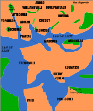
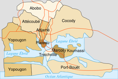
The Metropolitan area of Abidjan is located in Southern Côte d'Ivoire on the Ébrié Lagoon. The business district, the Plateau, is the centre of the city. It lies with Cocody, Deux Plateaux (the richest neighbourhood with mansions, typically inhabited by diplomats and the wealthy) and the slum area of Adjamé on the north shore of the lagoon, while Treichville and Marcory (mixed economically) lie to the south, Abobo-Doume and Yopougon to the west and Boulay Island in the middle of the lagoon. Further south lies Port Bouët, home to the airport and main seaport. Abidjan is located at .
Urban distribution
The urban distribution appears disorganized. Indeed, Abidjan, an immense city home to approximately 2,500,000 people, has seen its population doubling every seven years since 1945. Where does such growth come from? From the future opportunities it represents for the rural people. And so, this city which accounts for 45% of the habitants of Côte d'Ivoire and contributes to 20% of the country's population endures a population invasion from rural peasant folk hoping for a better life. However if a major rise has been noticed for nearly half a century, the fact remains that now this growth does not come closer than 4.5% per annum (compared to 10% from 1960 to 1990), with only about 1/3 contribution of rural migration (2/3 from 1960 to 1990). However, in spite of this fall, the city is still gigantic compared to the second most important city of the country, Bouaké (1,500,000 inhabitants) or even to the capital Yamoussoukro (100,000 inhabitants).
Administration
Before 2002
Before 2002, there existed a City of Abidjan (Ville d'Abidjan). The city of Abidjan was subdivided into ten communes, each with their municipal council and their mayor. Above the 10 communes was the central city hall, with a city-wide mayor (maire d'Abidjan), often colloquially called "super-maire".
The city of Abidjan was inside the département of Abidjan. This département was made up of the city of Abidjan, plus three subprefectures outside of the city of Abidjan. The département of Abidjan was itself inside the Lagunes région.
Since 2002
In August 2001, the government of Côte d'Ivoire disbanded the City of Abidjan. Instead, the ten communes of Abidjan were merged with the three subprefectures beyond the City of Abidjan to create the District of Abidjan (District d'Abidjan), whose limits match those of the département of Abidjan. The new District of Abidjan (2,119 km²/818 square miles) is thus much larger than the former City of Abidjan (422 km²/163 square miles). The reform was implemented in 2002, with local elections taking place that year.
The district of Abidjan is made up of the following subdivisions:
- Abidjan Ville (422 km²/163 square miles): the territory of the former City of Abidjan, made up of ten autonomous communes,
Ten communes
- Abobo
- Abobo is primarily made up of Working Class Housing.
- Adjamé
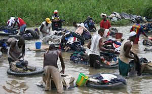
- Although small in size, Adjamé commune is a very important contributor to the Côte d'Ivoire economy due to a number of commercial activities. Unfortunately, Adjamé is prone to serious Health & Sanitation problems.
- Attécoubé
- The Banco forest, a national park, is within Attécoubé commune. Currently it is also known for a gigantic commercial complex, undoubtedly largest of Abidjan.
- Cocody
- Reputed for its residential districts (e.g.: 2-Plateau, Riviera), Cocody is also home to the University of Cocody - a publicly-owned establishment. The television house ( RTI) is in Cocody. It should be noted that the President of the Republic resides in this commune.
- Koumassi
- Koumassi is the Industrial zone.
- Biétry - Zone 4
- Deluxe residential zone, many French live here.
- Marcory
- Marcory is primarily residential.
- The Plateau
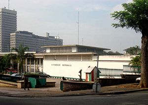
- The Plateau is a Central Business District, whose tall buildings give Abidjan a modern aspect. Although the administrative capital of Côte d'Ivoire was moved to Yamoussoukro in 1983, republic institutions such as the Presidency, and the National Assembly are still within the Plateau.
- Port-Bouët
- The refinery (SIR) and the international Felix Houphouët-Boigny airport is located in Port-Bouët.
- Treichville
- The Port Authority of Abidjan is located in Treichville, the Harbour Zone is also an industrial park. Also located in Treichville are various other important establishments, like the Treichville State Swimming Pool (FART), Palais Omnisport de Treichville, cultural palace, and the Abidjan Hippodrome.
- Île Boulay
- Yopougon
- Yopougon is composed of industrial and residential parks. It is also the most populated commune of Abidjan.
Each of these communes is governed by its own Municipal Corporation, headed by a Mayor.
Abobo, Adjamé, Attécoubé, Cocody, Plateau and Yopougon are located North of the Ébrié Lagoon (called Abidjan North) on the continental side of Abidjan.
Treichville, Koumassi, Marcory and Port-Bouët form part of Abidjan South.
Blokosso and Locodjro are villages included within the city and which maintain their cultural identity in the urban environment.
It should be noted that the distinction between Abidjan Ville and areas outside of Abidjan Ville is purely statistical, much like the distinction between Inner London and Outer London. The administration of the district is unified, covering both Abdijan Ville and areas outside of Abidjan Ville.
Executive power is in the hands of the District Governor (Governor du District), appointed by the president of Côte d'Ivoire. The governor serves a 5-year term. The governor of the district of Abidjan is the de facto mayor of Abidjan, and is often presented as such in international context.
Legislative power is in the hands of the District Council (Conseil du District). The District Council is made up of 78 members, who serve a 5-year term. One-third of the members are chosen by the municipal councils of the communes making up the district of Abidjan. Two-third of the members are directly elected every five years by the Ivorian citizens living in the District of Abidjan.
The District of Abidjan is inside the Lagunes région, which is made up of the District of Abidjan plus five départements.
Economy
Industry
Major industries include food processing, coffee, cocoa, lumber, automobile manufacturing, and the manufacture of textiles, chemicals, and soap. There is also a large oil refinery. Abidjan is also a large commercial sea port, forming a gateway for the industrial world to and from Western Africa
Energy
The District, contributes approximately half of the national production of electricity (600 MV over 1200), 42% of the customers low voltage and 54% Medium Average.
Telecommunications
Ivory Coast Telecom has a powerful fixed telephony network with 450,000 lines (2004), providing High speed Internet Connection, Specialised lines, and ADSL. Several Access Providers like Aviso de Cote d'Ivoire Télécom, Africa On Line, Globe Access etc. operate within the city.
Banking
Abidjan is home to representation of all the major international financial institutions: The World Bank, the IMF, BAD, BOAD, etc. Banking commission of the UEMOA, Regional Values Exchange, and subsidiaries of the large international banks: BNP, General company, Crédit Lyonnais, Citibank, Chase, Barclays etc.
Stock exchange
The Common Stock Exchange of West Africa (BRVM) is located in Abidjan, which is traded on by companies of the Côte d'Ivoire.
Transport
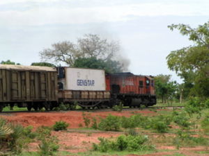
Trains on the line to Ouagadougou run from several stations in the city, the most important being in Treichville. Ferries link Treichville, Abobo-Doumé and the Plateau. The airport is located approximately 10 mi/16 km from downtown Abidjan.
The SOTRA (Society of Transportation, Abidjan) and the SOTU (Society of Urban Transportation) ensure regular urban transportation by means of Bus, Taxi baggage and Ligne Express train.
Modes
- SOTRA Autobus
- Ligne Express
- Taxi SOTRA
- Autobus SOTU
- Ferry
- Gbaka (a type of mini bus, with a capacity of about 18 passengers)
- Woro-woro (a shared taxi which can carry 5 to 6 passengers)
- Collective Taxi
- Taxi Brousse (8-9 passengers)
- Tramway
Abidjan tramway
The last of the projects in Abidjan is the electric train which the Ivory Coast Railroad Company (Cicf) promised. The development of infrastructure including a suburban train system in Abidjan is evaluated at nearly 100 billion Fcfa, and should connect the North-West to the East and the North of the town of Abidjan. This project extends 25 kilometres (16 mi) from the current railway operated by Sitarail (a subsidiary of the Bolloré group). Infrastructure works were estimated to cost 40 billions Francs,CFA financed by the State of Côte d'Ivoire, and the backers (World Bank and AFD). In addition, a BOT type concession contract for 20 to 30 years would be alloted to a private contractor for the operation of the network. This operator will undertake the acquisition and transportation of material, restoration of workshops, and installation of the operating system. The contract has been evaluated at 60 billion Francs CFA.
Port of Abidjan
Abidjan's modern port opened in 1950, when the Vridi Canal was cut through a sandbar, linking the Ébrié Lagoon with the Gulf of Guinea and the Atlantic Ocean. The harbour traffic was 12 million tons in 1995, including 5.5 in petroleum products. Formerly West Africa's pre-eminent port, Abidjan is attempting to bring back traffic which veered to other ports during Côte d'Ivoire's political unrest. Since a military coup in December 1999, as well as widespread civil unrest in the ensuing years, traffic has switched to other main regional ports such as Accra, Lome, Cotonou and Dakar.
Port Bouet Airport (DIAP/ABJ)
Abidjan has a large international airport able to accommodate all large transport aircraft. Approximately one flight hour away from most regional capitals, Abidjan is served by the most international air carriers.
The airport has a 3,000-metre (9,800 ft) runway, Instrument Landing System 3B equipment, 25 check-in counters, and nine boarding access points. AERIA, Abidjan Airport Management Company, operates and manages the airport area and relevant indirect services. There is a military apron at the airport. Private aircraft usually park in the commercial area, away from the terminal. Fencing and lighting are adequate at this facility.
Bridges
The two halves of the city (northern Abidjan and southern Abidjan) are connected by the Houphouët-Boigny and de Gaulle bridges. These bridges are located between Treichville and the Plateau, their capacity is definitely insufficient, especially during peak hours. This report has encouraged the government to study a project for the construction of a third bridge which should be located between Cocody and Marcory. Unfortunately, the political disturbances that the country has suffered since December 1999 have put this project out of the lime light. However the project had begun, with inhabitants relocated, buildings were also destroyed in Marcory opposite the Mille Maquis (the famous restaurant La Bâche bleue was also relocated).
Culture
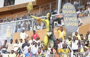
Abidjan is considered a crossroads of Western Africa art and music. It hosts various arts festivals, while many musical groups, such as Magic System are from the city.
Annual events
Music
- Concerto Festival
- les Top d'or
- International Festival of Black Music (FIMNA). Every 2 years, alternating with the:
- International Jazz Festival of Abidjan (FIJA)
- Hip-hop is back festival.
- Faya Flow
- Dj Mix Atalakou
- Festival de Maracana d'Abidjan FESTMA which is held at Yopougon
- The RTI Music Awards
Dance
- Festival of Urban Dances
Pagents
- International Festival of lingerie and beauty, Abidjan (FILBA)
- Miss Noel (6-11 years)
- Miss Abidjan District
- Miss Côte D'Ivoire
Cinema
- FESNACI (Cinema Festival)
Other events
- Festival MASA.
- Féeries
- Le Tiercé Gagnant
- Climbie beach Festival
- International Comics Festival
Foreign relations
Abidjan is the regional seat of the several international institutions: UNICEF, UNDP, WHO, WFP, UNOPS, FNUAP, ILO, the IMF, etc. Several nations of the world have full representation in Abidjan serving the entire region. It is in Abidjan that the American Embassy of West Africa is located, as well as the African Bank of Development (BAD) which moved for awhile to Tunisia.
Twinship
The city is twinned with:
 Kumasi in Ghana (twinned with Treichville)
 Marseille in France
 São Paulo in Brazil
 San Francisco in United States of America
 Tianjin in People's Republic of China
Security
- The law requires that travelers in Abidjan carry one of the following: national identity card, employee card, consular card, residency permit or passport.
- Although the overall situation in Abidjan has stabilized since the resurge in violence in November 2004, there are continual reports of violence. The U.N. has stated "its concern over the security situation" throughout Côte d'Ivoire, particularly in Abidjan.
- The current political situation is highly unstable and security risks are acute due to ongoing conflict.
Ongoing conflict
As the economic capital and largest city in Côte d’Ivoire, violence due to ongoing conflict remains a concern in Abidjan. Although the security situation has stabilized significantly since November 2004 and citizens have resumed regular daily activities, sporadic violence still occurs. Pro-government militia groups have previously been concentrated in the Adjamé district. There have been isolated incidents of violence between the militia and local residents.
Demonstrations
Abidjan has been the site of sporadic protests, some of which have turned violent. Demonstrations have normally been over political issues revolving around political opposition groups and disgruntled military personnel. The Young Patriots, a pro-government youth group, conducted a series of protests throughout the country in March 2005 to demand the withdrawal of French peacekeeping troops.
On September 6, 2006 hundreds of people protested in the streets after the death of two children who had inhaled fumes from toxic waste (See: 2006 Ivory Coast toxic waste spill) .
Crime
Even before the September 2002 mutiny, the crime rate has continually increased as a result of poor economic conditions, an influx of weapons and refugees from neighboring Liberia, and urban migration. Burglaries commonly occur at residences, restaurants, and small businesses. Petty theft is prevalent throughout Abidjan and armed gangs are a growing problem. Tourists are frequently robbed on the Houphouet-Boigny and Charles de Gaulle bridges.
Sports
The national sports of Côte d'Ivoire are basketball, athletics, rugby, handball and volleyball. Football (Soccer) is mostly played in Abidjan, where most of the top clubs, such as ASEC Mimosas and Africa Sports National, are located.
Football (Soccer)
- Fédération Ivoirienne de Football
Clubs
- ASEC Mimosas
- Africa Sports National
- Inconditionnel d'Adjamé
- Jeunesse Club d'Abidjan
- FC Satellite
- Stade d'Abidjan
- Stella Club d'Adjamé
Basketball
- Fédération Ivoirienne de Basketball
Clubs
- Abidjan Basket Club
- ASEC Mimosas
Sports complexes
Football and Rugby Stadium
- Félix Houphouët-Boigny Stadium
- Robert Champroux Stadium
- Municipal de Man FC Stadium
- Municipal d' Abidjan Stadium
- INJS Stadium
Others
- Palais omnisport de Treichville
Monuments and museums
This is an incomplete list.
- National Library
- National Museum
- Saint-Paul of Abidjan Cathedral in the Abidjan archidiocèse (designed by architect: Aldo Spiritom)
- Village Kiyi - M'Bock ( in the Riviera)
- Chocolate city
- Cocody
- Museum of Contemporary Art, Cocody
- American Cultural Centre (CCA)
- Goethe Institute
- Le Point d'Orgue
- Municipal Museum
- Plateau
- The Plateau Mosque
- Place la Sorbone
- French Cultural Centre (CCF)
- Ivory Coast Museum of Civilisations
- Treichville
- Palais de la Culture - Cultural Palace
- Palais des sports - Sports Palace
- Handicrafts Centre of the City of Abidjan ( CAVA)
- Yop city
- Maquis Le Texas earlier roland-garros
- La Celebre Rue Princesse, considered by some as the most animated street of Africa.
- The Shangai
- Marcory
- Le MG ( Marcory Gazoil) a part of the 1000 maquis
- The " 1000 maquis" located at Marcory
