Image:Global tropical cyclone tracks-edit2.jpg
From Wikipedia, the free encyclopedia

Size of this preview: 640 × 320 pixels
Full resolution (8,000 × 4,000 pixels, file size: 5.73 MB, MIME type: image/jpeg)
| |
This image was selected as picture of the day on the English Wikipedia for October 3, 2006. |
File history
Click on a date/time to view the file as it appeared at that time.
| Date/Time | Dimensions | User | Comment | |
|---|---|---|---|---|
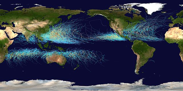
| current | 00:36, 5 August 2006 | 8,000×4,000 (5.73 MB) | Nilfanion | (== Summary == This map shows the tracks of all Tropical cyclones which formed worldwide from 1985 to 2005. The points show the locations of the storms at six-hourly intervals and use the colour scheme from [[w:Saffir-Simpson Hurrican) |
File links
The following pages on Schools Wikipedia link to this image (list may be incomplete):
Categories: Wikipedia featured pictures
