Image:Planisphæri cœleste.jpg
From Wikipedia, the free encyclopedia
Size of this preview: 640 × 438 pixels
Full resolution (1,804 × 1,236 pixels, file size: 3.09 MB, MIME type: image/jpeg)
| |
This is a file from the Wikimedia Commons. The description on its description page there is shown below. |
Description
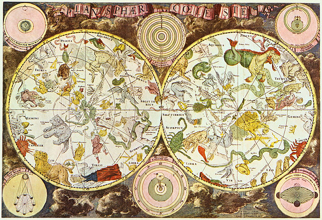
| Description |
Latina: Planisphæri cœleste English: Celestial map from the 17th century, by the Dutch cartographer Frederik de Wit. Français : Carte céleste du XVII ème siècle, réalisée par le cartographe hollandais Frederik de Wit. |
|||||||||
|---|---|---|---|---|---|---|---|---|---|---|
| Source |
Originally from en.wikipedia; description page is/was here. Scanned by Janke |
|||||||||
| Date |
10 March 2007 |
|||||||||
| Author |
|
|||||||||
| Permission ( Reusing this image) |
This image is in the public domain due to its age.
|
|||||||||
Original upload log
(All user names refer to en.wikipedia)
- 2007-03-10 18:20 Janke 1804×1236×8 (3237455 bytes) Celestial map from the 17th century, by the Dutch cartographer Frederik de Wit. Scanned by uploader
Licensing
 |
This image (or other media file) is in the public domain because its copyright has expired. This applies to the United States, Canada, the European Union and those countries with a copyright term of life of the author plus 70 years. العربية | Asturianu | Български | Català | Česky | Dansk | Deutsch | English | Ελληνικά | Esperanto | Español | Euskara | فارسی | Français | Gaeilge | Galego | עברית | हिन्दी | Bahasa Indonesia | Italiano | 日本語 | 한국어 | Kurdî / كوردی | Lietuvių | Magyar | Nederlands | Norsk (nynorsk) | Македонски | Bahasa Melayu | Polski | Português | Română | Русский | Slovenčina | Slovenščina | Shqip | Suomi | Sámegiella | Türkçe | 中文(简体) | 中文(繁體) | 粵語 | +/- |
File history
Click on a date/time to view the file as it appeared at that time.
| Date/Time | Dimensions | User | Comment | |
|---|---|---|---|---|
| current | 00:18, 29 May 2007 | 1,804×1,236 (3.09 MB) | STyx | ({{Information |Description= {{la}}Planisphæri cœleste {{en}}Celestial map from the 17th century, by the Dutch cartographer Frederik de Wit. {{fr}}Carte céleste du XVII ème siècle, réalisée par le cartographe hollandais Frederik de Wit. {{du}}[http) |
File links
Metadata
This file contains additional information, probably added from the digital camera or scanner used to create or digitize it. If the file has been modified from its original state, some details may not fully reflect the modified file.
| Orientation | Normal |
|---|---|
| Horizontal resolution | 300 dpi |
| Vertical resolution | 300 dpi |
| Software used | Adobe Photoshop CS Macintosh |
| File change date and time | 20:13, 10 March 2007 |
| Colour space | 65535 |