Image:Iran BMNG.png
From Wikipedia, the free encyclopedia
Size of this preview: 521 × 479 pixels
Full resolution (2,104 × 1,935 pixels, file size: 5.6 MB, MIME type: image/png)
| |
This is a file from the Wikimedia Commons. The description on its description page there is shown below. |
 |
This image is in the public domain because it is a screenshot from NASA’s globe software World Wind using Blue Marble, Landsat or USGS layer, all of which are in public domain. |
|
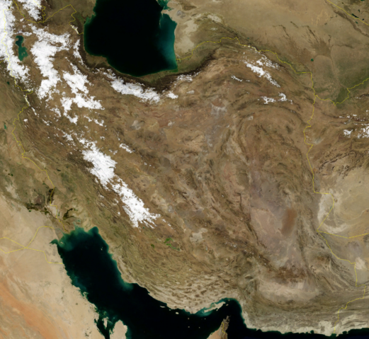
Satellite image of Iran in January 2004.
Screenshot from NASA World Wind, Blue Marble Next-Generation layer.
File history
Click on a date/time to view the file as it appeared at that time.
| Date/Time | Dimensions | User | Comment | |
|---|---|---|---|---|
| current | 16:27, 23 April 2006 | 2,104×1,935 (5.6 MB) | Hautala | ({{PD-WorldWind}} Satellite image of Iran in January 2004. Screenshot from NASA World Wind, Blue Marble Next-Generation layer. Category:Satellite images of countries) |
File links
The following pages on Schools Wikipedia link to this image (list may be incomplete):