Image:Canada Provinces Territories 1905.png
From Wikipedia, the free encyclopedia
No higher resolution available.
Canada_Provinces_Territories_1905.png (280 × 230 pixels, file size: 20 KB, MIME type: image/png)
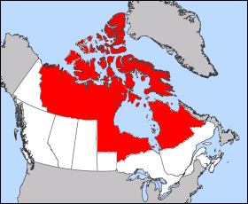
Images was created from Image:Northwest Territories-map.png please improve this map on anyway you see fit.
 |
I, the copyright holder of this work, hereby release it into the public domain. This applies worldwide. In case this is not legally possible, |
|
|
The Wikimedia Commons has another file with the same name as this file. To include the Commons media file in Wikipedia, this locally stored file needs to be renamed. | |
File history
Click on a date/time to view the file as it appeared at that time.
| Date/Time | Dimensions | User | Comment | |
|---|---|---|---|---|
| current | 01:59, 21 September 2005 | 280×230 (20 KB) | Cloveious ( Talk | contribs) | (Uploaded a more accurate version of the map, with correct 1905 Labrador boundaries) |
| revert | 04:22, 14 September 2005 | 281×230 (20 KB) | Cloveious ( Talk | contribs) | (Uploading a new free version I created to over come objections to feature article status. This was created from the Image:Image:Northwest Territories-map.png) |
| revert | 09:52, 4 September 2005 | 427×410 (22 KB) | Maclean25 ( Talk | contribs) | (Image was taken from http://atlas.gc.ca with the following copyright notice: "Information on this site has been posted with the intent that it be readily available for personal and public non-commercial use and may be reproduced, in part or in whole and b) |
See the setup instructions for more information.
File links
The following pages on Schools Wikipedia link to this image (list may be incomplete):
Categories: User-created public domain images