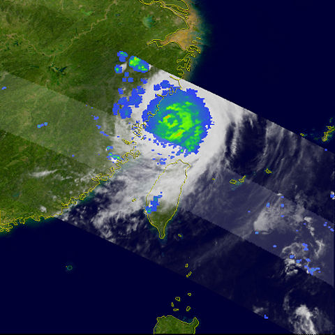
Image:Saomaitrmm.jpg
From Wikipedia, the free encyclopedia

Size of this preview: 480 × 480 pixels
Full resolution (1,024 × 1,024 pixels, file size: 727 KB, MIME type: image/jpeg)
File history
Click on a date/time to view the file as it appeared at that time.
| Date/Time | Dimensions | User | Comment | |
|---|---|---|---|---|
| current | 03:55, 6 September 2006 | 1,024×1,024 (727 KB) | Coredesat | (TRMM satellite image showing rainfall distribution within Typhoon Saomai as it makes landfall in Zhejiang, China. Image is from the [http://earthobservatory.nasa.gov/NaturalHazards/natural_hazards_v2.php3?img_id=13772 NASA Earth Observatory].) |
File links
The following pages on Schools Wikipedia link to this image (list may be incomplete):
Metadata
This file contains additional information, probably added from the digital camera or scanner used to create or digitize it. If the file has been modified from its original state, some details may not fully reflect the modified file.
| Width | 1024 |
|---|---|
| Height | 1024 |
| Compression scheme | Uncompressed |
| Pixel composition | RGB |
| Orientation | Normal |
| Number of components | 3 |
| Horizontal resolution | 72 dpi |
| Vertical resolution | 72 dpi |
| Data arrangement | chunky format |
| Software used | Adobe Photoshop CS2 Macintosh |
| File change date and time | 16:12, 10 August 2006 |
| Colour space | 65535 |

