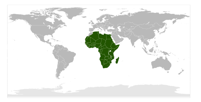
Image:Location of the African Union.svg
From Wikipedia, the free encyclopedia

Location_of_the_African_Union.svg (SVG file, nominally 940 × 477 pixels, file size: 1.31 MB)
File history
Click on a date/time to view the file as it appeared at that time.
| Date/Time | Dimensions | User | Comment | |
|---|---|---|---|---|
| current | 04:53, 4 July 2008 | 940×477 (1.31 MB) | Reisio | (silly moroccan patrol (rvl)) |
| 00:23, 4 July 2008 | 940×477 (1.31 MB) | Xiquet | (Reverted to version as of 21:17, 2 July 2008) | |
| 13:50, 3 July 2008 | 940×477 (1.31 MB) | Reisio | (silly moroccan patrol (rvl)) | |
| 21:17, 2 July 2008 | 940×477 (1.31 MB) | Xiquet | (Reverted to version as of 22:19, 18 June 2008) | |
| 00:02, 21 June 2008 | 940×477 (1.31 MB) | Reisio | (Reverted to version as of 16:38, 27 March 2008) | |
| 22:19, 18 June 2008 | 940×477 (1.31 MB) | Xiquet | (SADR don't administer Western Sahara.) | |
| 16:38, 27 March 2008 | 940×477 (1.31 MB) | Mangwanani | ({{Information |Description=Map showing location of the African Union |Source=self-made from Image:BlankMap-World6-Equirectangular.svg and Image:LocationAfricanUnion.png |Date=27 March 2008 |Author= Mangwanani |Permission= |ot) |
File links
The following pages on Schools Wikipedia link to this image (list may be incomplete):
