Image:Surface analysis.gif
From Wikipedia, the free encyclopedia
No higher resolution available.
Surface_analysis.gif (640 × 480 pixels, file size: 26 KB, MIME type: image/gif)
| |
This is a file from the Wikimedia Commons. The description on its description page there is shown below. |
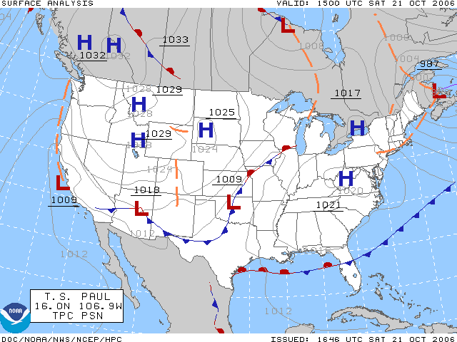
The surface analysis for the United States on October 21, 2006. Plotted by the HPC.
Source Website: Aviation Digital Data Service (ADDS)
Licencing
 |
This image is in the public domain because it contains materials that originally came from the U.S. National Oceanic and Atmospheric Administration, taken or made during the course of an employee's official duties. |
 |
File history
Click on a date/time to view the file as it appeared at that time.
| Date/Time | Dimensions | User | Comment | |
|---|---|---|---|---|
| current | 23:51, 28 January 2007 | 640×480 (26 KB) | BenFrantzDale | (Same picture, changed red and blue to be less vivid.) |
| 18:33, 21 October 2006 | 640×480 (26 KB) | Runningonbrains | (The surface analysis for the United States on October 21, 2006. Plotted by the HPC. ==Licencing== {{PD-USGov-NOAA}}) |
File links
The following pages on Schools Wikipedia link to this image (list may be incomplete):