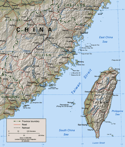
Image:Taiwan Strait.png
From Wikipedia, the free encyclopedia
Size of this preview: 408 × 479 pixels
Full resolution (681 × 800 pixels, file size: 207 KB, MIME type: image/png)
| |
This is a file from the Wikimedia Commons. The description on its description page there is shown below. |
- Description: Map of the Taiwan Strait
- Source: "The following maps were produced by the U.S. Central Intelligence Agency, unless otherwise indicated."
- URL: Perry-Castañeda Library]
Cleaned up version of en:Image:Taiwan straits.jpg, which is a work by the United States' government.
 |
This image is a work of a Central Intelligence Agency employee, taken or made during the course of the person's official duties. As a Work of the United States Government, all images created or made by the CIA are in the public domain, with the exception of classified information. |  |
File history
Click on a date/time to view the file as it appeared at that time.
| Date/Time | Dimensions | User | Comment | |
|---|---|---|---|---|
| current | 03:31, 15 January 2005 | 681×800 (207 KB) | MikeEdwards | (Map of the Taiwan Strait -- pulled from Wikipedia for use in Wikinews{{GFDL}}) |
File links
The following pages on Schools Wikipedia link to this image (list may be incomplete):