Image:Avalanche path 7271.JPG
From Wikipedia, the free encyclopedia
Size of this preview: 360 × 480 pixels
Full resolution (1,200 × 1,600 pixels, file size: 799 KB, MIME type: image/jpeg)
| |
This is a file from the Wikimedia Commons. The description on its description page there is shown below. |
Summary
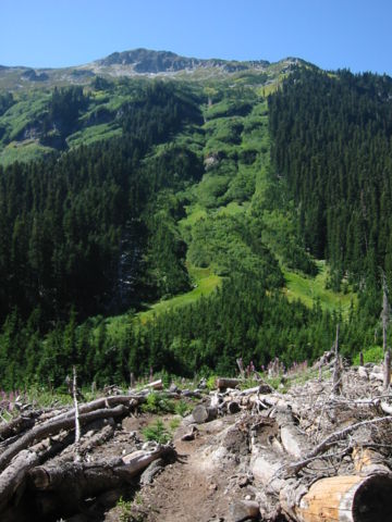
Avalanche path
| Description |
English: Avalanche chute from Pt. 7276 feet with woody debris in foreground
|
|---|---|
| Source |
Own work |
| Date |
2003:08:31T12:56:45-7.00 |
| Author |
Walter Siegmund |
| Permission ( Reusing this image) |
See below
|
| Camera location |
|
See this image at its location on Google Maps This location on: Live Maps - Trails.com - TerraServer-USA |
|---|
- Location Datum: WGS84/NAD83
- Viewpoint location: 2.5 km southwest of Buck Creek Pass on Buck Creek Trail, Glacier Peak Wilderness
- Viewpoint elevation: 4460 foot (1359 m)
- View direction: West
- Camera: Canon PowerShot S110
- Exposure Time: 1/200
- F Number: f/7.2
- Focal Length: 5.4
- Focal Length In 35mm Film:
- Flash: No
- ISO Speed Rating:
©2006 Walter Siegmund
Licensing
|

| |
This media file is uncategorized. Please help improve this media file by adding it to one or more categories, so it may be associated with related media files ( how?), and so that it can be more easily found. Please notify the uploader with
Deutsch | English | Español | Français | Italiano | 日本語 | Português | +/- |
File history
Click on a date/time to view the file as it appeared at that time.
| Date/Time | Dimensions | User | Comment | |
|---|---|---|---|---|
| current | 04:05, 15 March 2006 | 1,200×1,600 (799 KB) | Wsiegmund | ('''Avalanche chute''' * '''Description:''' Avalanche path from Pt. 7276' with woody debris in foreground ( Glacier Peak Wilderness) * '''Viewpoint location:''' 2.5 km southwest of Buck Creek Pass on Buck Creek Trail ( Glacier Peak Wilderness) * '''L) |
File links
Metadata
This file contains additional information, probably added from the digital camera or scanner used to create or digitize it. If the file has been modified from its original state, some details may not fully reflect the modified file.
| Camera manufacturer | Canon |
|---|---|
| Camera model | Canon PowerShot S110 |
| Exposure time | 1/200 sec (0.005) |
| F-number | f/7.2 |
| Date and time of data generation | 12:56, 31 August 2003 |
| Lens focal length | 5.40625 mm |
| Orientation | Normal |
| Horizontal resolution | 180 dpi |
| Vertical resolution | 180 dpi |
| File change date and time | 12:56, 31 August 2003 |
| Y and C positioning | 1 |
| Exif version | 2.1 |
| Date and time of digitizing | 12:56, 31 August 2003 |
| Image compression mode | 3 |
| Shutter speed | 7.65625 |
| Aperture | 5.71875 |
| Maximum land aperture | 2.97085571289 |
| Subject distance | 1.45 metres |
| Metering mode | Pattern |
| Flash | 0 |
| Colour space | sRGB |
| Focal plane X resolution | 7766.99029126 |
| Focal plane Y resolution | 7741.93548387 |
| Focal plane resolution unit | inches |
| Sensing method | One-chip colour area sensor |