Image:BlankMap-World.png
From Wikipedia, the free encyclopedia
Size of this preview: 640 × 281 pixels
Full resolution (1,425 × 625 pixels, file size: 15 KB, MIME type: image/png)
| |
This is a file from the Wikimedia Commons. The description on its description page there is shown below. |
Summary
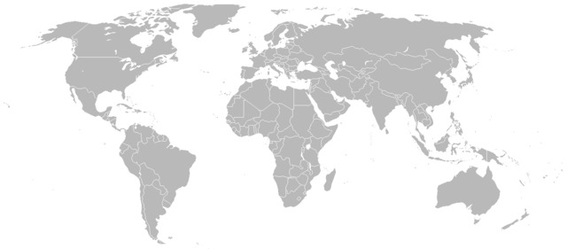
A blank map of the world as of 2008, with country outlines, for making country locator maps. This map uses the Robinson projection centered on the Greenwich Prime Meridian and includes various microstates and island nations. All territories indicated in the UN listing of territories and regions are exhibited.
The map was made by User:Vardion and adapted by User:E Pluribus Anthony for Wikipedia.
Version with additional miscellaneous islands at Image:BlankMap-World-alt.png. Also see v2 and v4 for versions with micro-states, and v3 and v5 for versions with microstates + thin lines joining country areas.
A version of this map is available with black lines for borders at Image:BlankMap-World-Borders.png.
Other blank maps are available at Wikipedia:Blank maps and Category:Blank maps of the world
If you plan on generating a new map for wikipedia by zooming in on this map and making some modifications, please consider a source map in SVG format instead, which will produce a higher quality image. These can be found in the SVG section at Wikipedia:Blank Maps
Other versions
 Vector version |
 A vector version of this image (SVG) is available. For more information about vector graphics, read about Commons transition to SVG. Deutsch | English | Español | Français | Galego | עברית | Magyar | Italiano | 日本語 | 한국어 | Lietuvių | Polski | Português | Русский | Српски / Srpski | Українська | +/- |
 |
Licensing
 |
This image has been released into the public domain by its author, Vardion. This applies worldwide. In some countries this may not be legally possible; if so: العربية | Български | Deutsch | Ελληνικά | English | Español | Français | Italiano | 日本語 | 한국어 | Polski | Русский | Српски / Srpski | Svenska | தமிழ் | Українська | 中文(繁體) | 中文(简体) +/- |
File history
Click on a date/time to view the file as it appeared at that time.
| Date/Time | Dimensions | User | Comment | |
|---|---|---|---|---|
| current | 14:48, 31 July 2008 | 1,425×625 (15 KB) | Avala | |
| 04:01, 12 April 2008 | 1,425×625 (57 KB) | Hoshie | (added St. John (USVI), St. Pierre and Miquelon, Turks and Caicos) | |
| 07:54, 5 April 2008 | 1,425×625 (57 KB) | Hoshie | (redrew Kosovo; added the insular parts of the French S. and Antarctic Lands based off of Image:TAAF-CIA WFB Map.png) | |
| 17:00, 17 February 2008 | 1,425×625 (57 KB) | IAMTHEEGGMAN | (Kosovo has declared independence from Serbia) | |
| 17:10, 26 January 2008 | 1,425×625 (15 KB) | Time3000 | (Optimise using Optipng, AdvanceCOMP and PNGOUT) | |
| 19:57, 26 November 2007 | 1,425×625 (49 KB) | Hoshie | (re-drew Australia's indian ocean territories ) | |
| 23:35, 9 November 2007 | 1,425×625 (49 KB) | Hoshie | (added Christmas Island % Cocos (Keeling) Islands and redrew Cabinda (Angola); under same lic. as before.) | |
| 03:59, 5 November 2007 | 1,425×625 (49 KB) | Wiz9999 | (Fixed colour issue in Luxembourg) | |
| 00:12, 4 October 2007 | 1,425×625 (30 KB) | R-41 | (Corrected the size of a British island added on the English Channel and corrected the size and position of two Greek islands on Greece's western coast.) | |
| 11:12, 25 September 2007 | 1,425×625 (49 KB) | Hoshie | (added Clipperton Island, St. Barthelemy, St. Martin, Yns Mon (Anglesey), the Isle of Wight. the Chagos (BIOT), SBAs on Cyprus, and Lough Neagh in NI. under same lic. as before.) | |
| 03:16, 8 September 2007 | 1,425×625 (30 KB) | R-41 | (Added two lakes near the Finnish-Russian border) | |
| 17:26, 4 September 2007 | 1,425×625 (30 KB) | R-41 | (Removed visability of Suez Canal, it probably is very narrow, and unlikely to easily be seen) | |
| 16:22, 4 September 2007 | 1,425×625 (30 KB) | R-41 | (Gibaltrer fixed) | |
| 15:59, 4 September 2007 | 1,425×625 (30 KB) | R-41 | (added more detail to Spain and other areas) | |
| 00:59, 4 September 2007 | 1,425×625 (30 KB) | R-41 | (Corrected various borders with more detail and gave more detail to some of the continents and islands as best as possible) | |
| 18:29, 3 September 2007 | 1,425×625 (30 KB) | R-41 | (Fixed up Indonesia more, with more detail as well as Russia) | |
| 14:52, 3 September 2007 | 1,425×625 (30 KB) | R-41 | (Corrected an earlier revision I made to Europe) | |
| 20:02, 30 August 2007 | 1,425×625 (30 KB) | R-41 | (Fixed up some overly simplified sections of South America, North and South Korea, Europe. ) | |
| 22:05, 20 August 2007 | 1,425×625 (30 KB) | R-41 | (Fixed up a lot of areas, such as Canada, Greece, Japan the Baltic, Indonesia, Greenland, and the Philippines and some other minor changes ) | |
| 13:43, 7 June 2007 | 1,425×625 (29 KB) | Aivazovsky | (Fixed the Maldives and added islands off the coast of Iran) | |
| 00:43, 5 April 2007 | 1,425×625 (14 KB) | David Levy | (better compression) | |
| 23:56, 15 March 2007 | 1,425×625 (28 KB) | Aivazovsky | (Fixing Cyprus) | |
| 03:17, 6 March 2007 | 1,425×625 (47 KB) | Hoshie | (added Gibraltar, Madeira, WSBA/ESBA, and SGSSI. Locator maps were used for Madeira and SGSSI.) | |
| 13:07, 15 February 2007 | 1,425×625 (28 KB) | Aivazovsky | (Adding bodies of water) | |
| 12:47, 15 February 2007 | 1,425×625 (28 KB) | Aivazovsky | (Fixing Slovenia and Cyprus) | |
| 01:31, 13 February 2007 | 1,425×625 (13 KB) | David Levy | (better compression) | |
| 06:43, 28 January 2007 | 1,427×628 (47 KB) | Wiz9999 | (Fixed some odd colouring issues with Algeria and Germany's border.) | |
| 00:31, 24 December 2006 | 1,425×625 (14 KB) | David Levy | (better compression) | |
| 08:17, 19 December 2006 | 1,427×628 (50 KB) | Hoshie | (Minor fixes for Singapore, Montenegro, and Monaco. Under same license as orginal.) | |
| 02:21, 18 December 2006 | 1,427×628 (29 KB) | Murraybuckley | ||
| 02:20, 18 December 2006 | 1,427×628 (29 KB) | Murraybuckley | ||
| 08:41, 15 December 2006 | 1,427×628 (47 KB) | Roke | (Reverted to earlier revision) | |
| 18:49, 12 December 2006 | 1,425×625 (18 KB) | David Levy | (better compression) | |
| 06:14, 8 December 2006 | 1,427×628 (47 KB) | Hoshie | (Added Cabinda. Under same license as original.) | |
| 02:16, 26 November 2006 | 1,427×628 (47 KB) | Hexagon1 | (fix polish off-colour blotches) | |
| 13:05, 15 October 2006 | 1,427×628 (30 KB) | Nádvorník | (White baltic Sea) | |
| 12:58, 9 August 2006 | 1,427×628 (47 KB) | Satesclop | ||
| 13:11, 26 June 2006 | 1,427×628 (28 KB) | 334a | (Reverted to earlier revision) | |
| 13:55, 15 June 2006 | 1,350×625 (29 KB) | Stern | (Reverted to earlier revision) | |
| 10:36, 9 June 2006 | 1,427×628 (28 KB) | Aivazovsky | ||
| 01:34, 9 June 2006 | 1,427×628 (28 KB) | Aivazovsky | (Fixing odd coloring mistakes) | |
| 01:24, 9 June 2006 | 1,427×628 (29 KB) | Aivazovsky | (Just the same as before except it includes Hawaii, the Galápagos Islands, the Canary Islands, and more detailed borders on Armenia and Nakhichevan.) | |
| 02:41, 5 June 2006 | 1,350×625 (29 KB) | Roke | (montenegro independent) | |
| 06:21, 28 March 2006 | 1,350×625 (14 KB) | David Levy | (better compression) | |
| 02:21, 28 March 2006 | 1,357×628 (27 KB) | E Pluribus Anthony | (World map: blank, with borders (2005)) | |
| 20:41, 26 March 2006 | 1,350×625 (14 KB) | David Levy | (better compression) | |
| 17:22, 26 March 2006 | 1,357×628 (27 KB) | E Pluribus Anthony | (World map: blank, with borders (2005)) | |
| 16:49, 26 March 2006 | 1,357×628 (27 KB) | E Pluribus Anthony | (World map: blank, with borders (2005)) | |
| 20:45, 24 February 2006 | 1,350×625 (14 KB) | David Levy | (Reverted to earlier revision) | |
| 03:54, 30 January 2006 | 1,357×628 (27 KB) | E Pluribus Anthony | (Reverted to earlier revision) | |
| 18:55, 15 January 2006 | 1,357×628 (45 KB) | QuartierLatin1968 | (Added Açores, Madeira, Canarias, St Helena, Réunion, and Rodrigues.) | |
| 08:28, 4 January 2006 | 1,357×628 (27 KB) | E Pluribus Anthony | (World map: blank, with borders (2005)) | |
| 09:44, 16 December 2005 | 1,350×625 (14 KB) | Yug | (Add Maldives and some Indian island) | |
| 16:36, 19 November 2005 | 1,350×625 (14 KB) | David Levy | (better compression) | |
| 22:16, 10 November 2005 | 1,357×628 (27 KB) | E Pluribus Anthony | (World map: blank, with borders (2005)) | |
| 06:24, 20 August 2005 | 1,357×628 (36 KB) | R.O.C | ||
| 07:32, 12 February 2005 | 1,357×628 (21 KB) | Dbenbenn | (pngcrushed version (losslessly compressed)) | |
| 04:50, 8 December 2004 | 1,357×628 (27 KB) | Vardion | (a blank map of the world) |
File links