Image:GreaterMiddleEast.gif
From Wikipedia, the free encyclopedia
Size of this preview: 640 × 296 pixels
Full resolution (1,357 × 628 pixels, file size: 24 KB, MIME type: image/gif)
Summary
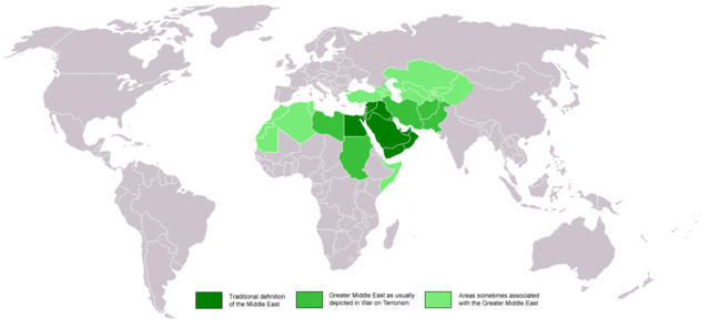
Map of the standard and Greater Middle Easts in various shades of green.
Licensing
 |
I, the copyright holder of this work, hereby release it into the public domain. This applies worldwide. In case this is not legally possible, |
|
|
The Wikimedia Commons has another file with the same name as this file. To include the Commons media file in Wikipedia, this locally stored file needs to be renamed. | |
File history
Click on a date/time to view the file as it appeared at that time.
| Date/Time | Dimensions | User | Comment | |
|---|---|---|---|---|
| current | 08:05, 11 June 2008 | 1,357×628 (24 KB) | Izmir lee ( Talk | contribs) | |
| revert | 07:58, 11 June 2008 | 1,357×628 (24 KB) | Izmir lee ( Talk | contribs) | |
| revert | 11:57, 24 September 2005 | 1,357×628 (22 KB) | CJWilly ( Talk | contribs) | (Map of the standard and Greater Middle Easts in various shades of green.) |
See the setup instructions for more information.
File links
The following pages on Schools Wikipedia link to this image (list may be incomplete):
Categories: User-created public domain images