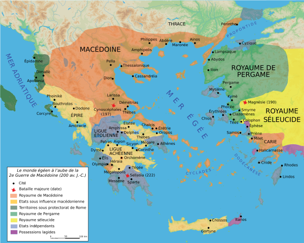
Image:Map Macedonia 200 BC-fr.svg
From Wikipedia, the free encyclopedia

Map_Macedonia_200_BC-fr.svg (SVG file, nominally 993 × 794 pixels, file size: 3.51 MB)
File history
Click on a date/time to view the file as it appeared at that time.
| Date/Time | Dimensions | User | Comment | |
|---|---|---|---|---|
| current | 18:29, 14 January 2007 | 993×794 (3.51 MB) | Bibi Saint-Pol | (vectorisation textes mers) |
| 22:15, 6 January 2007 | 993×794 (3.49 MB) | Bibi Saint-Pol | (typo ) | |
| 22:05, 6 January 2007 | 993×794 (3.49 MB) | Bibi Saint-Pol | (typo) | |
| 21:53, 6 January 2007 | 993×794 (3.49 MB) | Bibi Saint-Pol | (== Description == {{Information |Description= {{fr|Carte de la Macédoine et du monde égéen vers 200 av. J.-C.}} |Source=Création personnelle avec Adobe Illustrator (données basées sur R. Ginouvès et al., ''La Macédoine'', Paris, 1992). |Date=) |
File links
The following pages on Schools Wikipedia link to this image (list may be incomplete):


