Image:Indonesia blank map.svg

From Wikipedia, the free encyclopedia

Indonesia_blank_map.svg‎ (SVG file, nominally 1,322 × 620 pixels, file size: 359 KB)

Wikimedia Commons logo This is a file from the Wikimedia Commons. The description on its description page there is shown below.
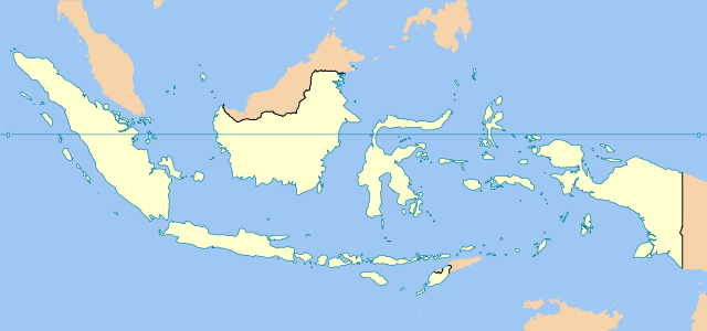
Commons is a freely licensed media file repository. You can help.
Description

Indonesia blank map

Source

Base map is Image:Southeast asia.svg

Date

2007

Author

en:User:Indon

Permission
( Reusing this image)
I, the copyright holder of this work, have published or hereby publish it under the following license:
GNU head Permission is granted to copy, distribute and/or modify this document under the terms of the GNU Free Documentation license, Version 1.2 or any later version published by the Free Software Foundation; with no Invariant Sections, no Front-Cover Texts, and no Back-Cover Texts. A copy of the license is included in the section entitled " GNU Free Documentation license".

Aragonés | العربية | Asturianu | Беларуская (тарашкевіца) | Български | বাংলা | ইমার ঠার/বিষ্ণুপ্রিয়া মণিপুরী | Brezhoneg | Bosanski | Català | Cebuano | Česky | Dansk | Deutsch | Ελληνικά | English | Esperanto | Español | Eesti | Euskara | فارسی | Suomi | Français | Gaeilge | Galego | עברית | Hrvatski | Magyar | Bahasa Indonesia | Ido | Íslenska | Italiano | 日本語 | ქართული | ភាសាខ្មែរ | 한국어 | Kurdî / كوردی | Latina | Lëtzebuergesch | Lietuvių | Bahasa Melayu | Nnapulitano | Nederlands | ‪Norsk (nynorsk)‬ | ‪Norsk (bokmål)‬ | Occitan | Polski | Português | Română | Русский | Slovenčina | Slovenščina | Shqip | Српски / Srpski | Svenska | తెలుగు | ไทย | Tagalog | Türkçe | Українська | اردو | Tiếng Việt | Volapük | Yorùbá | ‪中文(简体)‬ | ‪中文(繁體)‬ | +/-


Please note: This image is used in at least one case as a base map for a locator image; if you change or replace it in a way that moves its geographic features, images superimposed on it at specific locations will no longer be accurate. Please be careful. Thank you.

Legend

Colour Reference
  ocean
  foreign countries
  Indonesia territories
  international boundaries
  coastline and the horisontal equator line

Bounding box geo-coordinates

  • top = 9.1521
  • bottom = -13.5460
  • left = 94.2744
  • right = 142.8539

File history

Click on a date/time to view the file as it appeared at that time.

Date/Time Dimensions User Comment
current 21:02, 19 January 2007 1,322×620 (359 KB) Indon
20:55, 19 January 2007 1,324×628 (359 KB) Indon
17:22, 19 January 2007 1,405×626 (363 KB) Indon ({{Information |Description= Indonesia blank map |Source= Base map is Image:Southeast asia.svg |Date=2006 |Author= en:User:Indon |Permission={{GFDL self}} |other_versions= }})
The following pages on Schools Wikipedia link to this image (list may be incomplete):
The 2008 Wikipedia for Schools has a sponsor: SOS Children , and is mainly selected from the English Wikipedia with only minor checks and changes (see www.wikipedia.org for details of authors and sources). See also our Disclaimer.