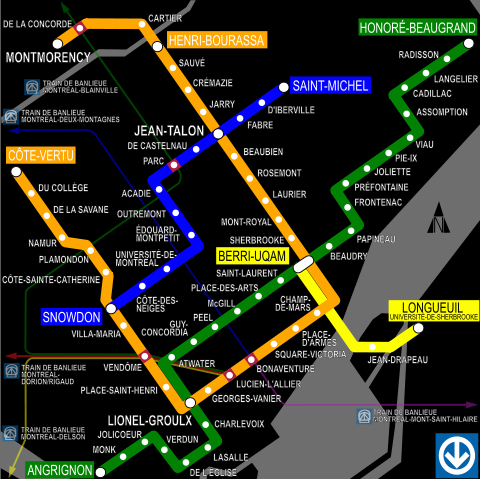
Image:Mtl-metro-map.svg
From Wikipedia, the free encyclopedia

Mtl-metro-map.svg (SVG file, nominally 500 × 499 pixels, file size: 592 KB)
| |
This image was previously a featured picture, but community consensus determined that it no longer meets our featured picture criteria. If you have a high quality image that you believe meets the criteria, be sure to upload it, using the proper free license tag, then add it to a relevant article and nominate it. |
| |
This image was selected as picture of the day on the English Wikipedia for August 18, 2004, and July 22, 2005. |
File history
Click on a date/time to view the file as it appeared at that time.
| Date/Time | Dimensions | User | Comment | |
|---|---|---|---|---|
| current | 04:09, 10 May 2007 | 500×499 (592 KB) | Sjschen | ({{Information |Description= Modified previous version for newest Montreal Metro extensions in the north. |Source=Self-made revision from version by User:Grm wnr |Date=May 10 |Author= User:Sjschen |Permission=GFDL }}) |
| 05:48, 17 April 2006 | 500×499 (593 KB) | Grm wnr | (Again with text as paths - the only way that works) | |
| 05:43, 17 April 2006 | 500×499 (147 KB) | Grm wnr | (Another attempt an an unified version) | |
| 05:34, 17 April 2006 | 500×499 (139 KB) | Grm wnr | (An attempt at an unified version) | |
| 04:15, 17 April 2006 | 500×499 (593 KB) | Grm wnr | (This is the plain SVG version, with the text converted to paths (because the SVG => PNG renderer screws it up otherwise, as can be plainly seen in the previous version)) | |
| 04:12, 17 April 2006 | 500×499 (158 KB) | Grm wnr | (This is the Inkscape SVG file with text-as-text, in case someone wants to modify it) |
File links
The following pages on Schools Wikipedia link to this image (list may be incomplete):
Categories: Wikipedia former featured pictures
