Image:Eritrea regions numbered.png
From Wikipedia, the free encyclopedia
No higher resolution available.
Eritrea_regions_numbered.png (400 × 351 pixels, file size: 8 KB, MIME type: image/png)
| |
This is a file from the Wikimedia Commons. The description on its description page there is shown below. |
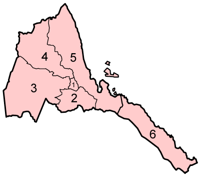
Map of the regions of Eritrea in geographic order, centered on Anseba and spiralling out clockwise.
Source: Made by User:Golbez.
| |
This file is licensed under Creative Commons Attribution 2.0 License |
\
File history
Click on a date/time to view the file as it appeared at that time.
| Date/Time | Dimensions | User | Comment | |
|---|---|---|---|---|
| current | 18:56, 9 July 2005 | 400×351 (8 KB) | Golbez | (Map of the regions of Eritrea in geographic order, centered on Anseba and spiralling out clockwise. Source: Made by User:Golbez. {{cc-by-2.0}} Category:Maps of Eritrea\) |
File links
The following pages on Schools Wikipedia link to this image (list may be incomplete):