Image:West Virginia population map.png
From Wikipedia, the free encyclopedia
Size of this preview: 611 × 479 pixels
Full resolution (691 × 542 pixels, file size: 30 KB, MIME type: image/png)
Summary
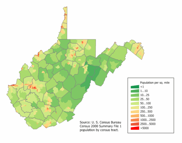
West Virginia population density map from Census 2000. See the data lineage for the process description.
Licensing
| |
I, the copyright holder of this work, hereby grant the permission to copy, distribute and/or modify this document under the terms of the GNU Free Documentation License, Version 1.2 or any later version published by the Free Software Foundation; with no Invariant Sections, no Front-Cover Texts, and no Back-Cover Texts. |
File history
Click on a date/time to view the file as it appeared at that time.
| Date/Time | Dimensions | User | Comment | |
|---|---|---|---|---|
| current | 11:56, 19 February 2006 | 691×542 (30 KB) | JimIrwin ( Talk | contribs) | (West Virginia population density map from Census 2000. See the data lineage for the process decription.) |
See the setup instructions for more information.
File links
The following pages on Schools Wikipedia link to this image (list may be incomplete):
Categories: U.S. State Population Maps | West Virginia maps | Self-published work | GFDL images