Image:LocationSaintHelena.png
From Wikipedia, the free encyclopedia
No higher resolution available.
LocationSaintHelena.png (250 × 115 pixels, file size: 5 KB, MIME type: image/png)
| |
This is a file from the Wikimedia Commons. The description on its description page there is shown below. |
| |
Permission is granted to copy, distribute and/or modify this document under the terms of the GNU Free Documentation License, Version 1.2 or any later version published by the Free Software Foundation; with no Invariant Sections, no Front-Cover Texts, and no Back-Cover Texts. Subject to disclaimers. |
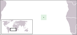
Location map for the Saint Helena.
Originally created for English Wikipedia by Vardion.
 |
This image has been released into the public domain by its author, Vardion. This applies worldwide. In some countries this may not be legally possible; if so: العربية | Български | Deutsch | Ελληνικά | English | Español | Français | Italiano | 日本語 | 한국어 | Polski | Русский | Српски / Srpski | Svenska | தமிழ் | Українська | 中文(繁體) | 中文(简体) +/- |
File history
Click on a date/time to view the file as it appeared at that time.
| Date/Time | Dimensions | User | Comment | |
|---|---|---|---|---|
| current | 16:44, 27 December 2004 | 250×115 (5 KB) | EugeneZelenko | (Location map for the Saint Helena.<br/>Originally created for English Wikipedia by Vardion.<br/>{{PD}}<br/> Category:Country locator maps) |
File links
The following pages on Schools Wikipedia link to this image (list may be incomplete):
Categories: Country locator maps | Maps of Saint Helena