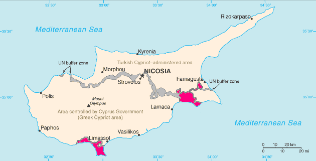
Image:Cyprus SBAsInRed.png
From Wikipedia, the free encyclopedia

No higher resolution available.
Cyprus_SBAsInRed.png (630 × 321 pixels, file size: 9 KB, MIME type: image/png)
File history
Click on a date/time to view the file as it appeared at that time.
| Date/Time | Dimensions | User | Comment | |
|---|---|---|---|---|
| current | 19:06, 3 June 2007 | 630×321 (9 KB) | Tene | (Optimised (0;r)) |
| 21:34, 26 August 2006 | 630×321 (27 KB) | Hoshie | (The map has been updated to show the color of the SBAs in the traditional pink colour.) | |
| 21:55, 9 August 2005 | 630×321 (20 KB) | Nicke L | (From en: Map of Cyprus with WSBA and ESBA in red. The map is adapted from the [http://www.cia.gov/cia/publications/factbook/maps/cy-map.gif CIA World Factbook] map. {{PD-USGov-CIA-WF}} Uploaded 14:03, 1 May 2005 by Hoshie [[Category:CIA factbook m) |
File links
The following pages on Schools Wikipedia link to this image (list may be incomplete):
Categories: Maps of Akrotiri and Dhekelia

