From Wikipedia, the free encyclopedia
 Size of this preview: 392 × 479 pixels
 Full resolution (1,400 × 1,711 pixels, file size: 1.51 MB, MIME type: image/gif)
 |
This is a file from the Wikimedia Commons. The description on its description page there is shown below.Commons is a freely licensed media file repository. You can help.
|
| Description |
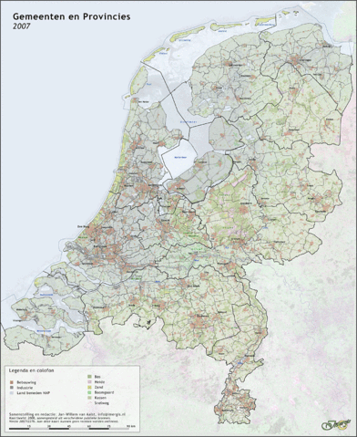
Nederlands: Kaart van gemeenten en provincies, grenzen per 1-1-2007 (1440 pix)
|
| Source |
Transfered from nl.wikipedia
(Original text : Jan-Willem van Aalst, samengesteld uit publiek beschikbare GIS data) |
| Date |
2007-12-28 (original upload date)
(Original text : 28 december 2007) |
| Author |
Original uploader was Janwillemvanaalst at nl.wikipedia
(Original text : Jan-Willem van Aalst) |
Permission
( Reusing this image) |
CC-BY-2.5-NL.
(Original text : CC Naamsvermelding 2.5)
|
License information
Janwillemvanaalst at nl.wikipedia, the copyright holder of this work, has published or hereby publishes it under the following license:

 |
Op dit werk is de Creative Commons licentie Naamsvermelding 2.5 Nederland (cc-by/nl) van toepassing. |
|
|
Original upload log
The original description page is/was here. All following user names refer to nl.wikipedia.
- 2007-12-28 08:43 Janwillemvanaalst 1400×1711×8 (1587196 bytes) {{Information |Description=Kaart van gemeenten en provincies, grenzen per 1-1-2007 (1440 pix) |Source=Jan-Willem van Aalst, samengesteld uit publiek beschikbare GIS data |Date=28 december 2007 |Author=Jan-Willem van Aalst |Permission=CC Naamsvermelding 2.
File history
Click on a date/time to view the file as it appeared at that time.
|
|
Date/Time |
Dimensions |
User |
Comment |
| current |
18:01, 28 December 2007 |
1,400×1,711 (1.51 MB) |
BotMultichill |
|
File links
The following pages on Schools Wikipedia link to this image (list may be incomplete):
