Image:Europe location UKR.png
From Wikipedia, the free encyclopedia
Size of this preview: 640 × 480 pixels
Full resolution (1,600 × 1,200 pixels, file size: 713 KB, MIME type: image/png)
| |
This is a file from the Wikimedia Commons. The description on its description page there is shown below. |
 |
This map image should be recreated using vector graphics as an SVG file. This has several advantages; see Commons:Media for cleanup for more information. If an SVG form of this image is already available, please upload it. After uploading an SVG, replace this template with {{ vector version available|new image name.svg}}. |
|
العربية | Български | Català | Česky | Dansk | Deutsch | English | Esperanto | Español | Français | Galego | 한국어 | Italiano | Magyar | Lietuvių | Nederlands | 日本語 | Polski | Português | Română | Русский | Suomi | Svenska | Türkçe | Українська | 中文(繁體) | 中文(简体) | +/- |
|
| Description |
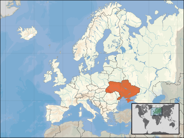
Deutsch: Lage der [[der Ukraine]] in Europa am 1. Januar 2007
English: Location of Ukraine in Europe on 1. Januar 2007
Français : Localisation du pays : Ukraine en Europe au 1er Janvier 2007
|
|||||||
|---|---|---|---|---|---|---|---|---|
| Date |
01.01.2007 |
|||||||
| Author Source & Permission |
|


File history
Click on a date/time to view the file as it appeared at that time.
| Date/Time | Dimensions | User | Comment | |
|---|---|---|---|---|
| current | 14:41, 1 January 2007 | 1,600×1,200 (713 KB) | David Liuzzo | ({{Europe location| |Staat=der Ukraine |State=Ukraine |Date=01.01.2007 }}) |
| 12:33, 30 September 2006 | 1,600×1,200 (112 KB) | David Liuzzo | ({{Information| |Description={{de|Lage der Republik Ukraine in Europa<BR>Stand: September 2006}} |Source= Own Work |Date= 30.09.2006 |Author= David Liuzzo |Permission={{self2|GFDL|Cc-by-sa-2.0-de}} |other_versions= }} [[Category:Maps) |