Image:HongKong boundary from space.png
From Wikipedia, the free encyclopedia
Size of this preview: 640 × 414 pixels
Full resolution (1,024 × 662 pixels, file size: 1.38 MB, MIME type: image/png)
| |
This is a file from the Wikimedia Commons. The description on its description page there is shown below. |
| Description |
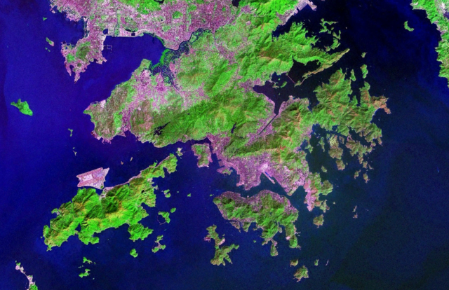
Satellite Image of Hong Kong |
|||
|---|---|---|---|---|
| Source |
NASA World Wind Software |
|||
| Date |
07:20, 5 November 2006 (UTC) |
|||
| Author |
NASA |
|||
| Permission ( Reusing this image) |
|
|||
| Other versions | Image:Hong Kong anotated zh.gif |

File history
Click on a date/time to view the file as it appeared at that time.
| Date/Time | Dimensions | User | Comment | |
|---|---|---|---|---|
| current | 07:20, 5 November 2006 | 1,024×662 (1.38 MB) | Tonync | ({{Information |Description= Satellite Image of Hong Kong |Source= NASA World Wind Software |Date= ~~~~~ |Author= NASA |Permission= {{NASA}} |other_versions= }} Category:Satellite pictures of Hong Kong) |
File links
The following pages on Schools Wikipedia link to this image (list may be incomplete):