Image:Southafricaracialdemographics1979.png
From Wikipedia, the free encyclopedia
Size of this preview: 613 × 479 pixels
Full resolution (940 × 735 pixels, file size: 914 KB, MIME type: image/png)
Summary
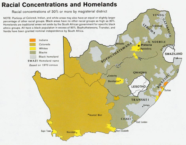
Racial of South Africa,based on 1970 census data.
Source
Map from the Perry-Castañeda Library Map Collection .
Originally produced by the Central Intelligence Agency, and in the Public Domain.
Licensing
 |
This work has been released into the public domain by the copyright holder. This applies worldwide. In case this is not legally possible: |
| |
This image is a copy of http://www.lib.utexas.edu/maps/africa/south_africa_racial_1979.jpg, a map from the map collection of the Perry-Castañeda Library (PCL) of the University of Texas at Austin. |
Removed from the following pages:
-- OrphanBot 13:26, 10 February 2007 (UTC)
File history
Click on a date/time to view the file as it appeared at that time.
| Date/Time | Dimensions | User | Comment | |
|---|---|---|---|---|
| current | 15:43, 1 September 2005 | 940×735 (914 KB) | AlbertR ( Talk | contribs) | (== Source == [http://www.lib.utexas.edu/maps/africa/south_africa_racial_1979.jpg]) |
See the setup instructions for more information.
File links
The following pages on Schools Wikipedia link to this image (list may be incomplete):
Categories: Copyright holder released public domain images | Images from the Perry-Castañeda Library | Apartheid in South Africa