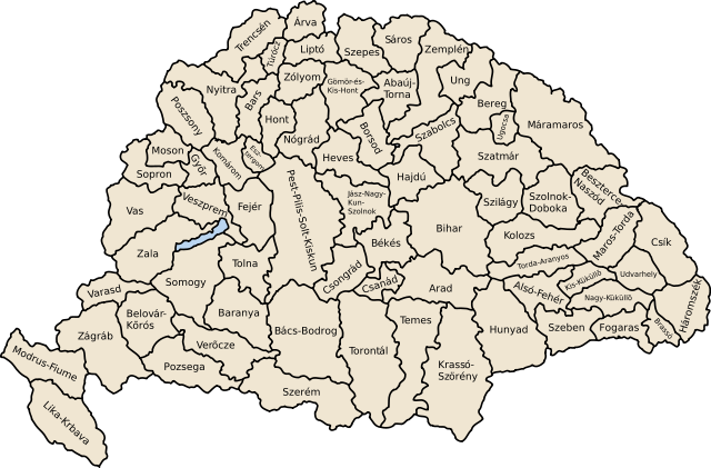
Image:Kingdom of Hungary counties.svg
From Wikipedia, the free encyclopedia

Kingdom_of_Hungary_counties.svg (SVG file, nominally 779 × 513 pixels, file size: 235 KB)
File history
Click on a date/time to view the file as it appeared at that time.
| Date/Time | Dimensions | User | Comment | |
|---|---|---|---|---|
| current | 20:25, 20 August 2007 | 779×513 (235 KB) | Xavax | (== Summary == {{Information| |Description= Map of counties of Hungary with Croatia & Slavonia, 1886-1918 |Source=own drawing |Date=April 30, 2006 |Author= User:IMeowbot |Permission= |other_versions= }} == Licensing == {{PD-self}} <!--Categories--> [[) |
| 22:10, 30 April 2006 | 779×513 (223 KB) | IMeowbot | (line weight) | |
| 21:34, 30 April 2006 | 779×513 (221 KB) | IMeowbot | ||
| 18:34, 30 April 2006 | 779×513 (195 KB) | IMeowbot | ({{Information| |Description= Map of late 1870s Hungary counties |Source=own drawing |Date=April 30, 2006 |Author= User:IMeowbot |Permission= |other_versions= }}) |
File links
The following pages on Schools Wikipedia link to this image (list may be incomplete):
Categories: Maps of the history of Hungary
