Image:Hautes-Fagnes.jpg
From Wikipedia, the free encyclopedia
Size of this preview: 640 × 480 pixels
Full resolution (2,272 × 1,704 pixels, file size: 1.93 MB, MIME type: image/jpeg)
| |
This is a file from the Wikimedia Commons. The description on its description page there is shown below. |
| Description |
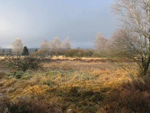
English: Typical landscape of the Hautes Fagnes, in East-Belgium, near the German border. Locality of Kutenhart, near Brackvenn (between Eupen -BE- and Monschau -DE-, near the village of Mützenich -DE-).
|
|---|---|
| Source |
Self-made picture (Aline) |
| Date |
end of December 2004 |
| Author |
Aline |
| Permission ( Reusing this image) |
GFDL
|
|

File history
Click on a date/time to view the file as it appeared at that time.
| Date/Time | Dimensions | User | Comment | |
|---|---|---|---|---|
| current | 21:40, 30 September 2005 | 2,272×1,704 (1.93 MB) | Elya | (Reverted to earlier revision) |
| 09:18, 27 March 2005 | 2,272×1,704 (1.93 MB) | Aline | (Self-made picture, end of December 2004. Typical landscape of the Hautes Fagnes, in East-Belgium, near the German border. Locality of Kutenhart, near Brackvenn (between Eupen -BE- and Monschau -DE-, near the village of Mützenich -DE-). License : GNU FD) |
File links
Metadata
This file contains additional information, probably added from the digital camera or scanner used to create or digitize it. If the file has been modified from its original state, some details may not fully reflect the modified file.
| Camera manufacturer | Canon |
|---|---|
| Camera model | Canon PowerShot G3 |
| Exposure time | 1/1250 sec (0.0008) |
| F-number | f/4.5 |
| Date and time of data generation | 12:32, 27 December 2004 |
| Lens focal length | 7.1875 mm |
| Orientation | Normal |
| Horizontal resolution | 180 dpi |
| Vertical resolution | 180 dpi |
| File change date and time | 10:55, 27 March 2005 |
| Y and C positioning | 1 |
| Software used | Adobe Photoshop CS Windows |
| Exif version | 2.2 |
| Date and time of digitizing | 12:32, 27 December 2004 |
| Image compression mode | 5 |
| Shutter speed | 10.28125 |
| Aperture | 4.34375 |
| Exposure bias | 0 |
| Maximum land aperture | 2 |
| Metering mode | Pattern |
| Flash | 16 |
| Colour space | sRGB |
| Focal plane X resolution | 8114.2857142857 |
| Focal plane Y resolution | 8114.2857142857 |
| Focal plane resolution unit | inches |
| Sensing method | One-chip colour area sensor |
| Custom image processing | Normal process |
| Exposure mode | Auto exposure |
| White balance | Auto white balance |
| Digital zoom ratio | 1 |
| Scene capture type | Standard |