Image:Continents vide couleurs.png
From Wikipedia, the free encyclopedia
Size of this preview: 640 × 325 pixels
Full resolution (1,488 × 755 pixels, file size: 58 KB, MIME type: image/png)
| |
This is a file from the Wikimedia Commons. The description on its description page there is shown below. |
Summary
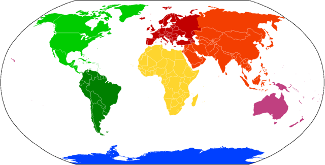
America:
██ North America
██ South America
Eurasia:
██ Asia
██ Europe
██ Africa
██ Australia/ Oceania
██ Antarctica
Licensing
|

earth is round
File history
Click on a date/time to view the file as it appeared at that time.
| Date/Time | Dimensions | User | Comment | |
|---|---|---|---|---|
| current | 14:36, 12 August 2008 | 1,488×755 (58 KB) | OlympiADdict | |
| 15:15, 8 October 2006 | 1,488×755 (37 KB) | Cogito ergo sumo | (World map: continents, w/countries) | |
| 13:46, 1 October 2006 | 1,420×655 (33 KB) | Cogito ergo sumo | (World map: continents, w/countries) | |
| 01:21, 28 September 2006 | 1,420×655 (33 KB) | Cogito ergo sumo | (World map: continents, w/countries) | |
| 21:17, 2 September 2006 | 1,420×655 (33 KB) | Cogito ergo sumo | (World map: continents, w/countries) | |
| 08:24, 14 April 2006 | 1,420×655 (33 KB) | E Pluribus Anthony | (World map: continents, w/countries) | |
| 07:01, 14 April 2006 | 1,420×655 (33 KB) | E Pluribus Anthony | (World map: continents, w/countries) | |
| 02:33, 28 March 2006 | 1,420×655 (33 KB) | E Pluribus Anthony | (World map: continents, w/countries) | |
| 18:03, 26 March 2006 | 1,420×655 (33 KB) | E Pluribus Anthony | (World map: continents, w/countries) | |
| 23:24, 25 March 2006 | 1,420×655 (33 KB) | E Pluribus Anthony | (World map: continents, w/countries) | |
| 21:18, 25 March 2006 | 1,420×655 (33 KB) | E Pluribus Anthony | (World map: continents, w/countries) | |
| 12:07, 6 January 2006 | 1,420×655 (33 KB) | E Pluribus Anthony | (World map depicting continents: tweaked) | |
| 06:59, 5 January 2006 | 1,420×655 (32 KB) | E Pluribus Anthony | (World map depicting continents: tweaked) | |
| 01:32, 5 January 2006 | 1,420×655 (33 KB) | E Pluribus Anthony | (World map depicting continents: tweaked) | |
| 19:32, 15 October 2005 | 1,420×655 (50 KB) | QuartierLatin1968 | ({{english}} Compiled chiefly from Image:BlankMap-World.png. Blank to permit labels in various languages. Controversial continents/subcontinents (i.e. one America or two, Eurasia vs Europe and Asia) are in different shades of the same colour. ~~~~ {{) |