Image:Detail of map of Plymouth, Devon circa 1600.PNG
From Wikipedia, the free encyclopedia
Size of this preview: 640 × 478 pixels
Full resolution (1,024 × 764 pixels, file size: 37 KB, MIME type: image/png)
Summary
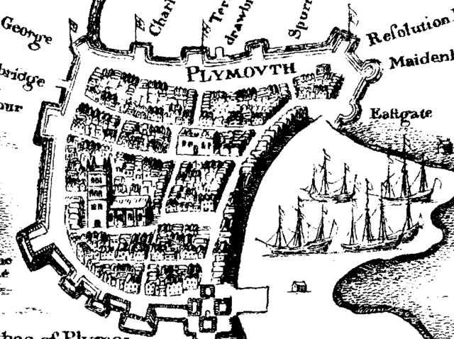
Detail of map of Plymouth, Devon circa 1600. I am fairly certain this map is out of copyright. Copies are available from Plymouth Central Library, Devon UK.
Note on the map St Andrew's Church to the lower centre left and Charles church to the upper centre. Charles church clearly does not have a roof or spire at this point.
Licensing
 |
This image is in the public domain because its copyright has expired in the United States and those countries with a copyright term of no more than the life of the author plus 100 years. |
File history
Click on a date/time to view the file as it appeared at that time.
| Date/Time | Dimensions | User | Comment | |
|---|---|---|---|---|
| current | 12:10, 23 March 2007 | 1,024×764 (37 KB) | Kevincolyer ( Talk | contribs) | (Detail of map of Plymouth, Devon circa 1600. I am fairly certain this map is out of copyright. Caopies are available from Plymouth Central Library, Devon UK.) |
See the setup instructions for more information.
File links
The following pages on Schools Wikipedia link to this image (list may be incomplete):
Categories: Author died more than 100 years ago public domain images | Plymouth