Image:LocationAfrica.png
From Wikipedia, the free encyclopedia
Size of this preview: 640 × 326 pixels
Full resolution (2,759 × 1,404 pixels, file size: 99 KB, MIME type: image/png)
| |
This is a file from the Wikimedia Commons. The description on its description page there is shown below. |
Summary
 |
This map image should be recreated using vector graphics as an SVG file. This has several advantages; see Commons:Media for cleanup for more information. If an SVG form of this image is already available, please upload it. After uploading an SVG, replace this template with {{ vector version available|new image name.svg}}. |
|
العربية | Български | Català | Česky | Dansk | Deutsch | English | Esperanto | Español | Français | Galego | 한국어 | Italiano | Magyar | Lietuvių | Nederlands | 日本語 | Polski | Português | Română | Русский | Suomi | Svenska | Türkçe | Українська | 中文(繁體) | 中文(简体) | +/- |
|
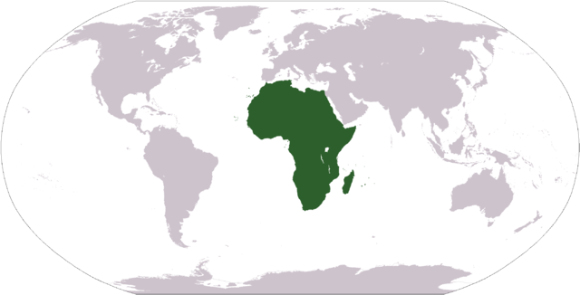
World map depicting Africa; map adapted from PDF world map at CIA World Fact Book
Licensing
 |
This image is in the public domain because it contains materials that originally came from the United States Central Intelligence Agency's World Factbook. Deutsch | English | Español | Français | 日本語 | Nederlands | 한국어 | Português | தமிழ் | Magyar | +/- |
 |
File history
Click on a date/time to view the file as it appeared at that time.
| Date/Time | Thumbnail | Dimensions | User | Comment | |
|---|---|---|---|---|---|
| current | 12:34, 19 January 2008 |  |
2,759×1,404 (99 KB) | F l a n k e r | (Transparency) |
| 05:15, 22 January 2006 |  |
2,759×1,404 (55 KB) | E Pluribus Anthony | (Reverted to earlier revision) | |
| 22:46, 15 January 2006 |  |
2,759×1,404 (84 KB) | Huhsunqu | ||
| 19:25, 3 November 2005 |  |
2,759×1,404 (55 KB) | E Pluribus Anthony | (World map: Africa (location)) | |
| 01:16, 8 October 2005 |  |
2,759×1,404 (55 KB) | E Pluribus Anthony | (World map: Africa (location)) | |
| 15:54, 29 April 2005 |  |
250×116 (11 KB) | Rex | (Eerdere versie hersteld) | |
| 15:20, 29 April 2005 | 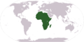 |
1,381×703 (16 KB) | Ghalas | (Corrected version {{PD-USGov-CIA-WF}}) | |
| 15:18, 29 April 2005 |  |
1,381×703 (16 KB) | Ghalas | (Corrected version {{PD-USGov-CIA-WF}}) | |
| 15:06, 29 April 2005 | 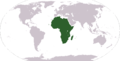 |
1,377×699 (16 KB) | Ghalas | (Extracted from CIA World Factbook PDF world map, then rasterized and colored. {{PD-USGov-CIA-WF}}) | |
| 06:39, 9 January 2005 | 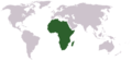 |
250×116 (11 KB) | Tobias Conradi | (from en:User:Morwen {{GFDL}}) |
File links
The following pages on Schools Wikipedia link to this image (list may be incomplete):
Categories: Maps of Africa