Image:Map of NATO countries.png
From Wikipedia, the free encyclopedia
Size of this preview: 640 × 244 pixels
Full resolution (742 × 283 pixels, file size: 10 KB, MIME type: image/png)
| |
This is a file from the Wikimedia Commons. The description on its description page there is shown below. |
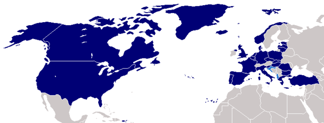
Description: Map of NATO countries.
██ NATO member states
██ Countries due to join 2009
Source: taken from the English Wikipedia.
The image was originally made by User:Donarreiskoffer. This version (corrected regarding Northern Ireland) is identical (except the size) to one uploaded by en:User:Mrowlinson which didn't have a copyright license.
 |
Permission is granted to copy, distribute and/or modify this document under the terms of the GNU Free Documentation license, Version 1.2 or any later version published by the Free Software Foundation; with no Invariant Sections, no Front-Cover Texts, and no Back-Cover Texts. A copy of the license is included in the section entitled " GNU Free Documentation license". Aragonés | العربية | Asturianu | Беларуская (тарашкевіца) | Български | বাংলা | ইমার ঠার/বিষ্ণুপ্রিয়া মণিপুরী | Brezhoneg | Bosanski | Català | Cebuano | Česky | Dansk | Deutsch | Ελληνικά | English | Esperanto | Español | Eesti | Euskara | فارسی | Suomi | Français | Gaeilge | Galego | עברית | Hrvatski | Magyar | Bahasa Indonesia | Ido | Íslenska | Italiano | 日本語 | ქართული | ភាសាខ្មែរ | 한국어 | Kurdî / كوردی | Latina | Lëtzebuergesch | Lietuvių | Bahasa Melayu | Nnapulitano | Nederlands | Norsk (nynorsk) | Norsk (bokmål) | Occitan | Polski | Português | Română | Русский | Slovenčina | Slovenščina | Shqip | Српски / Srpski | Svenska | తెలుగు | ไทย | Tagalog | Türkçe | Українська | اردو | Tiếng Việt | Volapük | Yorùbá | 中文(简体) | 中文(繁體) | +/- |
 |
This map image should be recreated using vector graphics as an SVG file. This has several advantages; see Commons:Media for cleanup for more information. If an SVG form of this image is already available, please upload it. After uploading an SVG, replace this template with {{ vector version available|new image name.svg}}. |
|
العربية | Български | Català | Česky | Dansk | Deutsch | English | Esperanto | Español | Français | Galego | 한국어 | Italiano | Magyar | Lietuvių | Nederlands | 日本語 | Polski | Português | Română | Русский | Suomi | Svenska | Türkçe | Українська | 中文(繁體) | 中文(简体) | +/- |
|
File history
Click on a date/time to view the file as it appeared at that time.
| Date/Time | Dimensions | User | Comment | |
|---|---|---|---|---|
| current | 15:25, 25 July 2008 | 742×283 (10 KB) | Rokerismoravee | (Reverted to version as of 14:47, 3 April 2008) |
| 23:12, 12 May 2008 | 742×283 (12 KB) | Patrickneil | (Adding Kosovo and Croatia's Adriatic coast, as proposed by en:User:OettingerCroat at the [[http://en.wikipedia.org/wiki/Image_talk:Map_of_NATO_countries.png English talk page].) | |
| 14:47, 3 April 2008 | 742×283 (10 KB) | Gugganij | (ALB & CRO are not yet members) | |
| 13:22, 3 April 2008 | 742×283 (15 KB) | Sparrowman980 | (The image was originally made by User:Donarreiskoffer. This version (corrected regarding Northern Ireland) is identical (except the size) to one uploaded by en:User:Mrowlinson which didn't have a copyright license. ) | |
| 13:21, 3 April 2008 | 742×283 (15 KB) | Sparrowman980 | (The image was originally made by User:Donarreiskoffer. This version (corrected regarding Northern Ireland) is identical (except the size) to one uploaded by en:User:Mrowlinson which didn't have a copyright license.) | |
| 07:31, 18 July 2007 | 742×283 (11 KB) | Hoshie | (re-did gray; Bermuda, and Crown Dependencies aren't in UK. Under Same lic. as orginal.) | |
| 03:00, 4 March 2007 | 742×283 (10 KB) | Aivazovsky | ||
| 23:33, 26 February 2007 | 742×283 (10 KB) | Aivazovsky | ||
| 20:37, 13 December 2006 | 741×289 (15 KB) | Hoshie | (Put the surrounding nations in a darker grey so boundries can be seen. Under same license as original.) | |
| 20:38, 25 July 2006 | 741×289 (15 KB) | Kseferovic | (This is an updated version of the map. Montenegro and Serbia are divided.) | |
| 16:54, 30 March 2006 | 741×289 (13 KB) | Valentinian | (Updated to include Corsica) | |
| 22:31, 18 October 2005 | 741×289 (14 KB) | Valentinian | (Updated to include Northern Ireland. This is identical (except the size) to a picture made by en:User:Mrowlinson (en:Image:Map_of_NATO_countries-u.png) but that image didn't have a copyright license, so I uploaded this in its place. The image was original) | |
| 11:27, 23 September 2005 | 741×289 (10 KB) | E Pluribus Anthony | (North Atlantic Treaty Organisation (NATO), members (2005)) | |
| 22:17, 13 December 2004 | 758×266 (15 KB) | Ævar Arnfjörð Bjarmason | (Map of NATO countries, taken from the english wikipedia. {{GFDL}} en:Image:Nato map.png is:Mynd:Aðildarríki Atlantshafsbandalagsins.png) |