Caracas
2008/9 Schools Wikipedia Selection. Related subjects: Central and South America; Cities
| Santiago de León de Caracas | |||
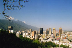
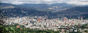
| Caracas from El Calvario | |||
|
|||
| Nickname(s): La Sultana del Ávila ("The Sultana of the Ávila") La Sucursal del Cielo ("Heaven's Branch (on Earth)" |
|||
| Motto: Ave María Santísima, sin pecado concebida, en el primer instante de su ser natural. ("Hail Holiest Mary, conceived without sin, in the first instant of Your Natural Being.") |
|||
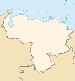
| Coordinates: | |||
|---|---|---|---|
| Country | Venezuela | ||
| States | Capital District, Miranda | ||
| Municipalities | Libertador, Chacao, Baruta, Sucre, El Hatillo | ||
| Founded | July 25, 1567 | ||
| Government | |||
| - Mayor | Juan Barreto | ||
| Area | |||
| - Total | 1,930 km² (745.2 sq mi) | ||
| Elevation | 900 m (2,953 ft) | ||
| Population (2001) | |||
| - Total | 2,762,759 | ||
| - Density | 1,431.5/km² (3,707.6/sq mi) | ||
| - Demonym | caraqueño(a) | ||
| Time zone | VST ( UTC-4:30) | ||
| - Summer ( DST) | not observed ( UTC-4:30) | ||
| Postal code | 1010-A | ||
| Area code(s) | 0212 | ||
| The area and population figures are the sum of the figures of the five municipalities (listed above) that make up the city of Caracas. | |||
| Website: alcaldiamayor.gob.ve (Spanish) | |||
Caracas (pronounced [kaˈɾakas]) is the capital and largest city of Venezuela. It is located in the north of the country, following the contours of the narrow Caracas Valley on the Venezuelan coastal mountain range (Cordillera de la Costa). The valley's temperatures are springlike. Terrain suitable for building on lies between 760 and 910 m (2,500 and 3,000 ft) above sea level. The valley is close to the Caribbean Sea, separated from the coast by a steep 2200 m (7400 ft) high mountain range, Cerro Ávila; to the south there are more hills and mountains.
El Distrito Metropolitano de Caracas (The Metropolitan District of Caracas) includes the Distrito Capital (the capital city proper) and four other municipalities in Miranda State including Chacao, Baruta, Sucre, and El Hatillo. The city of Caracas had an estimated population of 3,140,076 as of 2005. The population of Greater Caracas, including neighboring cities outside the Capital District proper, is approximately 4.7 million.
History
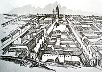
More than five hundred years ago, the area was populated by indigenous peoples and Caracas did not exist. Francisco Fajardo, the son of a Spanish Captain and a Guaqueri queen, attempted to establish a plantation in the valley in 1562 after founding a series of coastal towns. Fajardo's settlement did not last as it was destroyed by the locals led by Terepaima and Guacaipuro. This was the last rebellion on the part of the natives, for on July 25, 1567, the Spanish captain Diego de Losada laid the foundations of the city of Santiago de León de Caracas. The cultivation of cocoa stimulated the development of the city which in 1777 became the capital of the capitanía general of Venezuela.
An attempt at revolution to gain independence organized by José María España and Manuel Gual was put down on July 13, 1797. But the ideas of the French Revolution and the American Wars of Independence inspired the people, and on July 5, 1811 a Declaration of Independence was signed in Caracas. This city was the birthplace of two of Latin America's most important figures: Francisco de Miranda and "El Libertador" Simón Bolívar. An earthquake destroyed Caracas on March 26, 1812 and was portrayed by authorities as a divine punishment for rebelling against the Spanish Crown, during the Venezuelan War of Independence. The valley became a cemetery, and the war continued until June 24, 1821, when Bolívar gained a decisive victory over the Royalists at the Battle of Carabobo.
As the economy of oil-rich Venezuela grew steadily (during the first part of the 20th Century), Caracas became one of Latin America's economic centers, and was also known as the preferred hub between Europe and South America. During the 1950s, Caracas began an intensive modernization program which continued throughout the 1960s and early 1970s. The Universidad Central de Venezuela, designed by modernist architect Carlos Raúl Villanueva and now a UNESCO monument, was built. Joining El Silencio, also by Villanueva, several workers' (23 de Enero, Simon Rodriguez) and new middle class residential districts (Bello Monte, Los Palos Grandes, Chuao, Cafetal, etc.) sprouted in the valley, extending its limits towards the East and South East. On October 17, 2004, one of the Parque Central towers caught fire. The change in the economic structure of the country, now oil dependent, and the fast development of Caracas made it a magnet for the rural communities who migrated to the capital city in an unplanned fashion, creating the ranchos (slum) belt in the valley of Caracas.
Symbols
- Flag: The flag of Caracas consists of a burgundy red field with the version of the Coat of Arms of the City (effective since the 1980s). The red field symbolizes the blood spilled by Caraquenian people in favour of independence and the highest ideals of the Venezuelan Nation. Later, in the year 1994, presumably as a result of the change of municipal authorities, it was decided to increase the size of the Caracas coat of arms and move it to the centre of the field. This version of the flag is still in use today.
- Coat of arms: The coat of arms of the City of Caracas was adopted by the Libertador Municipality to identify itself. Later, the Metropolitan Mayor Office assumed the lion, the scallop and the St. James Cross for the same purpose.
- Anthem: The anthem of the City is the Marcha a Caracas by the composer Tiero Pezzuti de Matteis with the lyric by José Enrique Sarabia. The lyrics are said to be inspired by the heroism of the Caracas people, and the memory of the City of Red Roofs.
- Incidentally, the National Anthem of Venezuela " Gloria al Bravo Pueblo" recites: "...Y si el despotismo levanta la voz, seguid el ejemplo que Caracas dio." ("...and if despotism raises its voice, follow the example that Caracas gave.") ... reflecting the fact that, in addition to generously giving many heroic fighters to wage the War of Independence, the junta set up in Caracas on ( April 19, 1810) served as inspiration for other regions to do the same, as did its declaration of independece a year later.
Governance
Caracas has five municipalities: Baruta, El Hatillo, Chacao, Libertador and Sucre. The constitution of Venezuela specifies that municipal governments be divided into executive and legislative branches. The executive government of the municipality is governed by the mayor, while the legislative government is managed by the Municipal council. In March 8, 2000, the year after a new constitution was introduced in Venezuela, it was decreed in Gaceta Official N° 36,906 that the Metropolitan District of Caracas would be created, and that some of the powers of these municipalities would be delegated to the Alcaldía Mayor, physically located in Libertador municipality.
Economy
Caracas hosts numerous service companies, banks, and malls, among others. Most economic activity is in services, excepting some industries established in its metropolitan area. Caracas is home to the Caracas Stock Exchange and Petróleos de Venezuela (PDVSA). The PDVSA is the largest company in Venezuela and negotiates all the international agreements for the distribution and export of petroleum.
Small and medium industry also contribute to the economic capacity of Caracas. The city has excellent routes of communication and transportation between the metropolitan area and the country. Caracas is a regional centre for the distribution of products. The high concentration of population has also been an important factor for the growth of retail wholesale markets, which form the fastest-growing segment of commerce in the region. Important industries in Caracas include chemicals, textiles, leather, food, iron and wood products. There are also rubber and cement factories.
Geography
Caracas is contained entirely within a valley of the Venezuelan central range, and separated from the Caribbean coast by a roughly 15 km expanse of El Ávila National Park. The valley is relatively small and quite irregular, the altitude with respect to sea level varies from between 870 and 1,043 meters (2,854–3,422 ft), with 900 meters (2,953 ft) in the historic zone. This, along with the rapid population growth, has profoundly influenced the urban development of the city. The most elevated point of the Capital District, wherein the city is located, is the Pico El Ávila, which rises to 2,159 meters (7,083 ft). The main body of water in Caracas is the Guaire river, which flows across the city and empties into the Tuy river, which is also fed by the El Valle and San Pedro rivers, in addition to numerous streams which descend from El Ávila. The La Mariposa and Camatagua reservoirs provide water to the city.
Climate
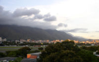
The climate of Caracas is intertropical, with precipitation that varies between 900 and 1,300 millimeters (35–51 in) (annual), in the city proper, and up to 2,000 millimeters (79 in) in some parts of the Mountain range. The annual average temperature is approximately of 22.5 °C (73 °F), with the average of the coldest month (January) 22 °C (72 °F) and the average of the warmest month (May) 24 °C (75 °F), which gives little annual thermal amplitude, of 3°C. The daily thermal amplitude is greater (more than 10°C/18°F), superior to 30 °C (86 °F), that rare times descend to less from 25 °C (77 °F). In the months of December and January abundant fog may appear, in addition to a sudden nightly drop in temperature, until reaching 13 °C (55 °F) or less, this peculiar weather is known by the natives of Caracas as the Pacheco. In addition, nightly temperatures at any time of the year usually do not remain above 20 °C (68 °F), which results in very pleasant evening temperatures. Hail storms appear in Caracas, although only on rare occasions. Electrical storms are much more frequent, especially between June and October, due to the city being in a closed valley and the orographic action of Cerro El Ávila.
| Weather averages for Caracas | |||||||||||||
|---|---|---|---|---|---|---|---|---|---|---|---|---|---|
| Month | Jan | Feb | Mar | Apr | May | Jun | Jul | Aug | Sep | Oct | Nov | Dec | Year |
| Average high °F | 77 | 79 | 81 | 82 | 82 | 80 | 79 | 80 | 81 | 80 | 80 | 78 | 80 |
| Average low °F | 63 | 65 | 66 | 68 | 70 | 69 | 68 | 68 | 68 | 68 | 67 | 65 | 67 |
| Precipitation inches | 1.10 | 0.70 | 0.90 | 1.10 | 1.40 | 2.10 | 2.20 | 2.00 | 2.10 | 2.20 | 2.10 | 2.10 | |
| Average high °C | 25 | 26 | 27 | 27 | 27 | 26 | 26 | 26 | 27 | 26 | 26 | 25 | 26 |
| Average low °C | 17 | 18 | 18 | 20 | 21 | 20 | 20 | 20 | 20 | 20 | 19 | 18 | 19 |
| Precipitation mm | 27.9 | 17.8 | 22.9 | 27.9 | 35.6 | 53.3 | 55.9 | 50.8 | 53.3 | 55.9 | 53.3 | 53.3 | |
| Source: weatherbase.com 2007-06-08 | |||||||||||||
| Source #2: weather.com June 8, 2007 | |||||||||||||
Colleges and universities
Central University of Venezuela
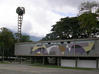
(Universidad Central de Venezuela in Spanish) is a premier public University of Venezuela located in Caracas. Founded in 1721, it is the oldest university in Venezuela and one of the first in Latin America. The university campus was designed by architect Carlos Raúl Villanueva and it was declared World Heritage by UNESCO in 2000. The Ciudad Universitaria de Caracas, as the main Campus is also known, is considered a masterpiece of architecture and urban planning and it is the only university campus designed in the 20th century that has received such recognition by UNESCO.
Simón Bolívar University
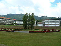
(Universidad Simón Bolívar in Spanish) or USB, is a public institution located in Caracas, Venezuela with scientific and technological orientation. Its motto is "La Universidad de la Excelencia" ("University of Excellence"). Both nationally and globally, Simón Bolívar University is a well-known school with a high reputation in scientific and engineering careers. Its graduates are known for achieving one of the highest professional standards in the world.
Sports
Most notably soccer and baseball teams are located in Caracas. Several other sports also have Caracas as their home. The baseball teams Tiburones de La Guaira and Leones del Caracas have like seat the Estadio Universitario de la UCV, of the Central University of Venezuela, with a capacity of 25 000 spectators. Another baseball team founded in Caracas, the Navegantes del Magallanes, even though it was moved to Valencia, Carabobo continues to have a following in the capital because of its historic rivalry with local teams.
Between the most important soccer stadiums we have:
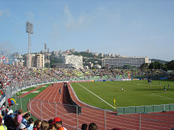
- Estadio Olímpico de la UCV, with capacity of 30 000 spectators (but is being extended to 40 000 for the Copa América 2007 and seat of the Caracas Fútbol Club and Deportivo Italia)
- Brígido Iriarte stadium, with a capacity of 12 000 spectators (old seat of the Caracas Fútbol Club and Deportivo Italchacao, and seat of the Estrella Roja FC). The Caracas Football Club opens its own stadium in August 2005, called Cocodrilos Sport Park.
Caracas for being the capital of Venezuela, has the seat of the National Institute of Sports and the Venezuelan Olympic Committee as well as of many clubs and national federations of a great diversity of disciplines. Bodybuilding, in particular Female Bodybuilding has become popular in Caracas as well. The most famous names being Betty Viana and Yaxeni Oriquen, who is also a Ms. Olympia champion. Both women are also natives of Caracas.
- Caracas hosted the 1983 Pan American Games
Sports teams
- Baseball: Leones del Caracas B.B.C.
- Soccer: Caracas Fútbol Club, Estrella Roja Futbol club, Deportivo Italia
- Basketball: Cocodrilos de Caracas B.B.C..
Culture
Caracas is Venezuela's cultural capital, boasting several restaurants, theaters, museums, and shopping centers. The city is also home to an array of immigrants from but not limited to: Spain, Italy, Portugal, the Middle East, Germany, China, and Latin American countries. Caracas has the reputation as being one of the most dangerous cities in Latin America.
Museums, libraries and cultural centres
Caracas, has been a city with great cultural aspirations throughout the course of its history. Institutions such as the old Atheneum bear witness to this awareness. The National library holds a great amount of volumes, and affords abundant bibliographic information for the student of the discovery and independence of Venezuela. The museum of Colonial Art has on show an interesting exhibition of Venezuelan art from the periods previous to its independence with fountains, furniture, colonial courtyards etc. In the Fine Arts Museum are kept some archaeological finds with some good examples of precolombine pottery.
Since 1974, Caracas has had a Contemporary Art Museum, containing works representing the most important tendencies in contemporary art, and since 1982, counts with a Children's Museum, a privately managed museum foundation, with the propose of teaching children about science, technology, culture and arts. The Natural Science Museum, has a rich collection os archaeological pieces from the primitive native cultures, in these collections and in other no less important galleries (Raúl Santana Creole Museum, Transport Museum, the Coin Museum, Bolivarian Museum, Jacobo Borges Museum, Carlos Cruz-Diez Museum, Alejandro Otero Museum, Sacred Museum, etc.) the cultural aspirations of Caracas are more than evident.
Gastronomy
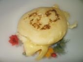
Caracas has a rich gastronomical heritage due to the influence of immigrants, leading to a wide choice of regional and international cuisine. There are a great variety of international restaurants including French, Italian, Spanish, Indian, Chinese, Japanese, and Mexican. The district of La Candelaria is well known for its Spanish restaurants, due to the number of Galician and Canarian immigrants that came to this area in the mid-20th century. Typical dishes include: Pabellón Criollo, empanadas, arepas, hallaca, black roast beef and chicken salad. Chicha, guarapo, carato and tizana (mixed beverage with fruits) are typical drinks.
Transportation
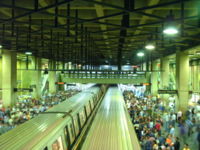
- The Caracas Metro has been in operation since 1981. With 04 lines and more than 50 stations, it covers a great part of the city, it also has an integrated ticket system, that combines the route of the Metro with those offered by the Metrobús, a bus service of the Caracas Metro. The Metro system works from 5:30 a.m. to 11:00 p.m.
- Buses are the main means of mass transportation. There are two bus systems: the traditional system and the Metrobús. The traditional system runs a variety of bus types, operated by several companies on normal streets and avenues:
- Autobus; large buses.
- Camioneta; medium size buses.
- microbus or camionetica; vans or minivans.
- IAFE; train services to and from Tuy Valley cities of Charallave and Cúa.
- The Simón Bolívar International Airport, the biggest and most important in the country is located outside the city, roughly 20 miles (32 km) from the downtown area. Taxis and Buses are available at the airport to provide transportation to the city.
Sister cities
Cities twinned with Caracas are:
 Cluj-Napoca, Romania
 Havana, Cuba
 Istanbul, Turkey
 Tehran, Iran
 Madrid, Spain
 Minsk, Belarus
 New Mumbai, India
 New Orleans, United States
 Quezon City, Philippines
 San Francisco, United States
 Sao Paulo, Brazil
Districts
| Caracas Districts | |
|---|---|
| Northwest | Catia • 23 de Enero • Propatria • Lomas de Urdaneta • Casalta • El Atlántico • Caño Amarillo • Los Magallanes de Catia • Alta Vista • Ruperto Lugo • Lídice • Gramoven • Manicomio |
| Centre | El Silencio • Capitolio • La Hoyada • Altagracia • La Pastora • Cotiza • Quinta Crespo • Guaicaipuro • La Candelaria |
| Southwest | Artigas • Vista Alegre • Bella Vista • Colinas de Vista Alegre • La Yaguara • Zona Industrial de La Yaguara • El Algodonal • Carapa • Antímano • Washington • Las Fuentes • El Paraíso • El Pinar • La Paz • El Paraíso • Montalbán • Juan Pablo II • La Vega • Las Adjuntas • Caricuao • Mamera |
| Centereastern | El Conde • Parque Central • San Agustín del Sur • San Agustín del Norte • Simón Rodríguez • Maripérez •La Colina • Las Palmas • Las Lomas • San Rafael • Los Caobos • Quebrada Honda • San Bernardino • La Campiña • La Florida • Alta Florida • Chapellín • Los Cedros • El Bosque • Chacaíto • Sabana Grande • Bello Monte |
| South | Cementerio • Los Carmenes • Los Castaños • Prado de Maria • La Bandera • Las Acacias • Colinas de las Acacias • Los Rosales • Valle Abajo • Los Chaguaramos • Ciudad Universitaria • Santa Mónica • Colinas de Santa Mónica • Colinas de Bello Monte • Cumbres de Curumo • El Valle • Los Jardines de El Valle • Coche • Delgado Chalbaud • La Rinconada |
| Eastern | Country Club • El Pedregal • San Marino • Campo Alegre • Chacao • Bello Campo • El Rosal • El Retiro • Las Mercedes • Tamanaco • Chuao • Altamira • Los Palos Grandes • La Castellana • La Floresta • Santa Eduvigis • Sebucán • La Carlota • Santa Cecilia • Campo Claro • Los Ruices • Montecristo • Los Chorros • Los Dos Caminos • Boleíta • Los Cortijos • La California • Horizonte • El Marqués • La Urbina • Terrazas del Ávila • El Llanito • Macaracuay • La Guairita • Caurimare • El Cafetal • San Román • Santa Rosa • San Luis • Santa Sofía • Santa Paula • Santa Inés • Los Pomelos • Palo Verde • Petare |
| Southeastern | Valle Arriba • Santa Fe • Los Campitos • Prados del Este • Alto Prado • El Peñón • Baruta • Piedra Azul • La Trinidad • La Tahona • Monterrey • Las Minas • Cerro Verde • Los Naranjos • La Boyera • Alto Hatillo • El Hatillo • Los Geranios • La Lagunita • El Placer • El Guayabao • El Volcán • La Unión • Sartanejas |
