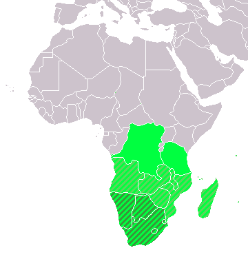
Image:LocationSouthernAfrica.png
From Wikipedia, the free encyclopedia

No higher resolution available.
LocationSouthernAfrica.png (360 × 392 pixels, file size: 14 KB, MIME type: image/png)
File history
Click on a date/time to view the file as it appeared at that time.
| Date/Time | Dimensions | User | Comment | |
|---|---|---|---|---|
| current | 08:11, 11 December 2007 | 360×392 (14 KB) | Hoshie | (added Cabinda (Angola) and Montenegro. ) |
| 16:01, 2 April 2006 | 360×392 (9 KB) | E Pluribus Anthony | (Reverted to earlier revision) | |
| 05:45, 1 April 2006 | 360×392 (14 KB) | Aris Katsaris | (Cleaner -- there's no need to include SADC at all here.) | |
| 18:41, 5 February 2006 | 360×392 (9 KB) | E Pluribus Anthony | (Map: Southern Africa (location)) |
File links
The following pages on Schools Wikipedia link to this image (list may be incomplete):
- Algeria
- Angola
- Benin
- Botswana
- British Indian Ocean Territory
- Burkina Faso
- Comoros
- Cameroon
- Cape Verde
- Central African Republic
- Chad
- Equatorial Guinea
- French Southern and Antarctic Lands
- Gabon
- Ghana
- Guinea
- Guinea-Bissau
- Libya
- Lesotho
- Liberia
- Malawi
- Mali
- Mauritius
- Mozambique
- Namibia
- Niger
- Nigeria
- Rwanda
- Saint Helena
- Sub-Saharan Africa
- Senegal
- Seychelles
- Sierra Leone
- Somalia
- Sudan
- Swaziland
- Tanzania
- Togo
- Tunisia
- Uganda
- Zimbabwe
- Zambia
- Côte d'Ivoire
- The Gambia
- São Tomé and Príncipe
- Democratic Republic of the Congo
- Réunion
- Ethiopia
- Kenya
- Republic of the Congo
- Southern Africa
- List of countries
- Africa
- France
- Egypt
- Djibouti
- Eritrea
- Burundi
- South Africa
- Mauritania
