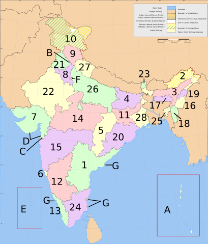
Image:India-states-numbered.svg
From Wikipedia, the free encyclopedia

India-states-numbered.svg (SVG file, nominally 1,594 × 1,868 pixels, file size: 304 KB)
States:
|
Union Territories: |
File history
Click on a date/time to view the file as it appeared at that time.
| Date/Time | Dimensions | User | Comment | |
|---|---|---|---|---|
| current | 07:51, 5 March 2007 | 1,594×1,868 (304 KB) | Nichalp | (Swapping Pondicherry NCT) |
| 05:59, 4 March 2007 | 1,594×1,868 (304 KB) | Nichalp | (Correction in the numbering scheme according to MoS) | |
| 15:58, 15 February 2007 | 1,594×1,868 (304 KB) | Nichalp | (Reverted to earlier revision) | |
| 00:39, 12 February 2007 | 1,594×1,868 (304 KB) | Abecedare | (Reverted to earlier revision) | |
| 06:07, 25 November 2006 | 1,594×1,868 (304 KB) | Nichalp | (Reverted to earlier revision) | |
| 23:14, 17 September 2006 | 1,594×1,868 (304 KB) | Bastique | ||
| 15:22, 17 June 2006 | 1,594×1,868 (304 KB) | Nichalp | (States of India, numbered. category:Maps of India) |
File links
The following pages on Schools Wikipedia link to this image (list may be incomplete):
Categories: Maps of India

