Image:BRP2.jpg
From Wikipedia, the free encyclopedia

Size of this preview: 640 × 346 pixels
Full resolution (1,600 × 864 pixels, file size: 193 KB, MIME type: image/jpeg)
Summary
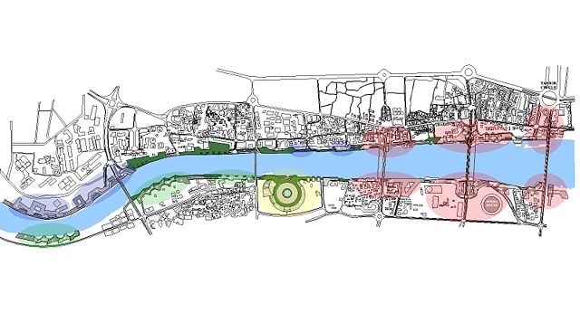
Layout of City Nodes of Development for Baghdad Renaissance Plan, Hisham n. Ashkouri/ARCADD, Inc.
Colored blobs
Top (from left to right): Two Medical districts (blue), Recreational and Historic districts (blue), and three Commercial districts (red).
Bottom (from left to right): Three Residential districts (green), an IT district (yellow), and three more Commercial districts (red).
Licensing
| |
This work is licensed under the Creative Commons Attribution-ShareAlike 2.5 License. |
File history
Click on a date/time to view the file as it appeared at that time.
| Date/Time | Dimensions | User | Comment | |
|---|---|---|---|---|
| current | 21:25, 11 August 2006 | 1,600×864 (193 KB) | Arcaddmarketing ( Talk | contribs) | (Layout of City Nodes of Development for Baghdad Renaissance Plan, Hisham n. Ashkouri/ARCADD, Inc.) |
See the setup instructions for more information.
File links
The following pages on Schools Wikipedia link to this image (list may be incomplete):
Categories: Creative Commons Attribution-ShareAlike 2.5 images | Maps of Baghdad