Image:Geocentric vs geodetic latitude with elevation.svg
From Wikipedia, the free encyclopedia

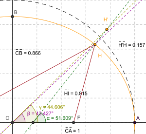
Geocentric_vs_geodetic_latitude_with_elevation.svg (SVG file, nominally 300 × 275 pixels, file size: 93 KB)
File history
Click on a date/time to view the file as it appeared at that time.
| Date/Time | Dimensions | User | Comment | |
|---|---|---|---|---|
| current | 23:36, 6 August 2008 | 300×275 (93 KB) | SharkD | (changed style of lines) |
| 23:35, 6 August 2008 | 300×275 (93 KB) | SharkD | (matched color of lines to colour of angles) | |
| 04:39, 6 August 2008 | 300×275 (95 KB) | SharkD | (image dimensions are now more convenient) | |
| 04:33, 6 August 2008 | 339×311 (95 KB) | SharkD | (changed colour of one of the angle measurements to purple) | |
| 04:31, 6 August 2008 | 339×311 (95 KB) | SharkD | (angle measurements were overlapping) | |
| 04:30, 6 August 2008 | 339×311 (95 KB) | SharkD | (Less wasted space, more readable in thumbnail sizes.) | |
| 03:00, 8 March 2008 | 830×633 (59 KB) | SharkD | (Angle markers were too hard to distinguish.) | |
| 20:15, 16 February 2008 | 830×633 (61 KB) | SharkD | (Image was too small.) | |
| 20:00, 16 February 2008 | 415×316 (61 KB) | SharkD | ({{Information |Description=Shows how corrections have to be made for height (altitude) when converting from geodetic to geocentric coordinates. |Source=self-made |Date=2008-02-16 |Author= SharkD |Permission= |other_versions= }} ) |
File links
The following pages on Schools Wikipedia link to this image (list may be incomplete):
