Image:Romanbritain.jpg
From Wikipedia, the free encyclopedia

Size of this preview: 303 × 480 pixels
Full resolution (880 × 1,394 pixels, file size: 180 KB, MIME type: image/jpeg)
File history
Click on a date/time to view the file as it appeared at that time.
| Date/Time | Dimensions | User | Comment | |
|---|---|---|---|---|
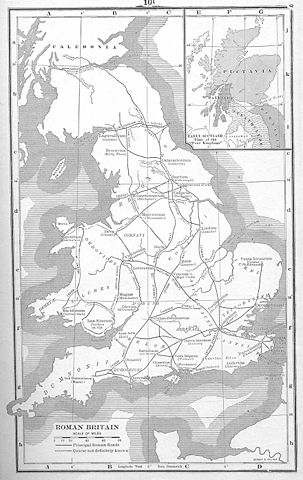
| current | 00:37, 21 July 2005 | 880×1,394 (180 KB) | Nicke L | (From the English Wikipedia Description: Map of Roman Britain from Atlas of European History, Earle W Dowe, London, G Bell & Sons, 1910 Uploaded 22:04, 1 April 2005 by Adamsan {{PD}} Category:Historical maps of the United Kingdom [[en:Image:Roma) |
| 00:35, 21 July 2005 | 378×599 (60 KB) | Nicke L | (From the English Wikipedia Description: Map of Roman Britain from Atlas of European History, Earle W Dowe, London, G Bell & Sons, 1910 Uploaded 22:04, 1 April 2005 by Adamsan {{PD}} Category:Historical maps of the United Kingdom [[en:Romanbrita) |
File links
The following pages on Schools Wikipedia link to this image (list may be incomplete):
Categories: Roman Britain | Roman roads in Britannia
