Image:1928 Okeechobee Flood.png
From Wikipedia, the free encyclopedia
Size of this preview: 501 × 480 pixels
Full resolution (855 × 819 pixels, file size: 172 KB, MIME type: image/png)
| |
This is a file from the Wikimedia Commons. The description on its description page there is shown below. |
Summary
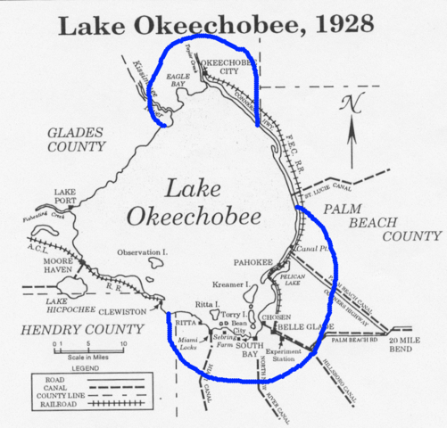
Map showing the area of the flood caused by the 1928 Okeechobee hurricane. Note: The Palm Beach County label is misplaced. North of Canal Point has been in Martin County since 1925. From .
Licensing
 |
This image is in the public domain because it contains materials that originally came from the U.S. National Oceanic and Atmospheric Administration, taken or made during the course of an employee's official duties. |
 |
File history
Click on a date/time to view the file as it appeared at that time.
| Date/Time | Dimensions | User | Comment | |
|---|---|---|---|---|
| current | 08:33, 7 October 2005 | 855×819 (172 KB) | Jdorje | (Map showing the area of the flood caused by the 1928 Okeechobee hurricane. From [http://www.srh.noaa.gov/mfl/newpage/Okeechobee.htm].) |
File links
The following pages on Schools Wikipedia link to this image (list may be incomplete):