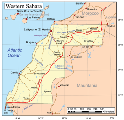
Image:Westernsaharamap.png
From Wikipedia, the free encyclopedia

Size of this preview: 493 × 480 pixels
Full resolution (600 × 584 pixels, file size: 256 KB, MIME type: image/png)
File history
Click on a date/time to view the file as it appeared at that time.
| Date/Time | Dimensions | User | Comment | |
|---|---|---|---|---|
| current | 21:42, 8 February 2007 | 600×584 (256 KB) | Kmusser | (Added graticule and scale, zoomed out a bit to include more surrounding area.) |
| 14:33, 2 February 2007 | 600×597 (209 KB) | Kmusser | (Added conveyer belt and a couple more towns.) | |
| 16:45, 31 January 2007 | 600×597 (203 KB) | Kmusser | (This is a general map of Western Sahara based primarily on the Digital Chart of the World. With [http://www.un.org/depts/Cartographic/map/dpko/minurso.pdf this UN map] and commercial atlases (Ran) |
File links
The following pages on Schools Wikipedia link to this image (list may be incomplete):