Image:TS Odette.jpg
From Wikipedia, the free encyclopedia
Size of this preview: 639 × 480 pixels
Full resolution (642 × 482 pixels, file size: 71 KB, MIME type: image/jpeg)
| |
This is a file from the Wikimedia Commons. The description on its description page there is shown below. |
| Description |
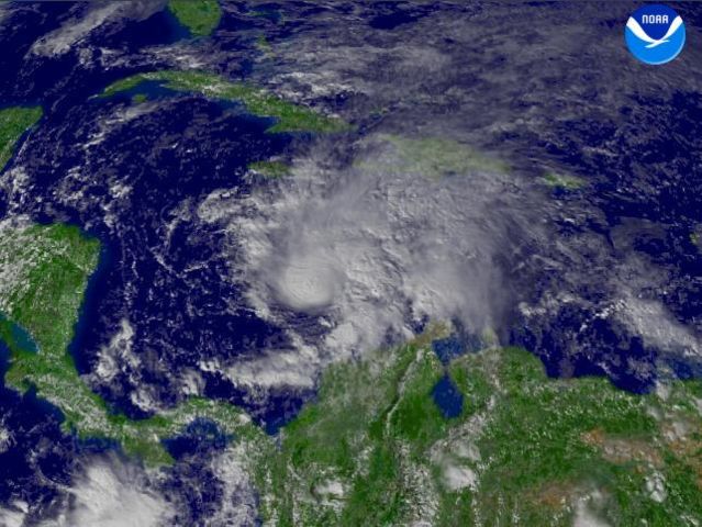
A 2100Z report said that Tropical Storm Odette was located west of Santo Domingo. This system moved northeast near 10 MPH and had winds near 40 MPH, with higher gusts. |
|||
|---|---|---|---|---|
| Source |
http://www.nnvl.noaa.gov/cgi-bin/index.cgi?page=items&ser=106850&large=1 |
|||
| Date |
2003-12-04 |
|||
| Author |
NOAA / Satellite and Information Service |
|||
| Permission ( Reusing this image) |
|


File history
Click on a date/time to view the file as it appeared at that time.
| Date/Time | Dimensions | User | Comment | |
|---|---|---|---|---|
| current | 23:46, 10 May 2006 | 642×482 (71 KB) | Hurricanehink | ({{Information| |Description= |Source=http://www.nnvl.noaa.gov/cgi-bin/index.cgi?page=items&ser=106850&large=1 |Date=2006-05-10 |Author=NOAA Environmental Visualization Program |Permission={{PD-USGov-NOAA}} |other_versions= }} [[Category:Atlantic hurrican) |
File links
The following pages on Schools Wikipedia link to this image (list may be incomplete):