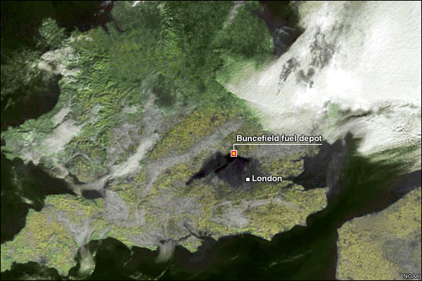
Image:Hemel Hempstead fuel explosion map.jpg
From Wikipedia, the free encyclopedia

No higher resolution available.
Hemel_Hempstead_fuel_explosion_map.jpg (600 × 400 pixels, file size: 72 KB, MIME type: image/jpeg)
File history
Click on a date/time to view the file as it appeared at that time.
| Date/Time | Dimensions | User | Comment | |
|---|---|---|---|---|
| current | 13:50, 28 December 2005 | 600×400 (72 KB) | Borb | (== Summary == Satellitenaufnahme von Südengland, die die schwarze Rauchwolke der Explosion bei London zeigt. Satellite image of Hemel Hempstead fuel explosion showing vapor cloud. Note: This is an updated version which shows the location of the oil dep) |
| 14:17, 11 December 2005 | 600×400 (67 KB) | Drak2 | ({{PD-USGov-DOC-NOAA}}) |
File links
The following pages on Schools Wikipedia link to this image (list may be incomplete):


