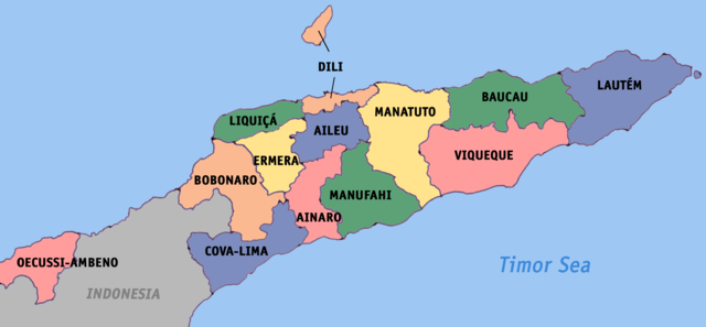
Image:Timor-Leste districts map.png
From Wikipedia, the free encyclopedia

Size of this preview: 640 × 297 pixels
Full resolution (3,180 × 1,476 pixels, file size: 392 KB, MIME type: image/png)
Summary
Map of Timor-Leste divided into districts.
Licensing
|
File history
Click on a date/time to view the file as it appeared at that time.
| Date/Time | Dimensions | User | Comment | |
|---|---|---|---|---|
| current | 04:20, 8 August 2007 | 3,180×1,476 (392 KB) | Scorpion prinz ( Talk | contribs) | (Map of Timor-Leste divided into districts. ) |
See the setup instructions for more information.
File links
The following pages on Schools Wikipedia link to this image (list may be incomplete):
Categories: GFDL images | Self-published work
