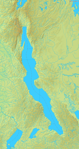
Image:Lake Tanganyika map.png
From Wikipedia, the free encyclopedia

Size of this preview: 254 × 479 pixels
Full resolution (728 × 1,373 pixels, file size: 493 KB, MIME type: image/png)
File history
Click on a date/time to view the file as it appeared at that time.
| Date/Time | Dimensions | User | Comment | |
|---|---|---|---|---|
| current | 07:16, 23 September 2006 | 728×1,373 (493 KB) | Mats Halldin | (Map of Lake Tanganyika Bounding box West 28°, South -9.5°, East 32°, North -2°. Centre at {{coor d|5.75000|S|30.00000|E|scale:4500000}}. {{demis-pd}} category:Lake Tanganyika) |
File links
The following pages on Schools Wikipedia link to this image (list may be incomplete):
