Image:ACW Chattanooga2Carolinas.png
From Wikipedia, the free encyclopedia
Size of this preview: 640 × 316 pixels
Full resolution (1,566 × 773 pixels, file size: 309 KB, MIME type: image/png)
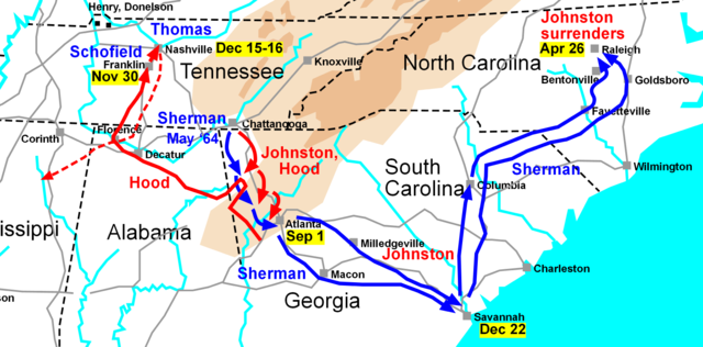
Map of the Western Theatre of the American Civil War, actions from Chattanooga to the Carolinas. Drawn by Hal Jespersen in Macromedia Freehand. Graphic source file is available at http://www.posix.com/CWmaps/
 |
I, the copyright holder of this work, hereby release it into the public domain. This applies worldwide. In case this is not legally possible, |
File history
Click on a date/time to view the file as it appeared at that time.
| Date/Time | Dimensions | User | Comment | |
|---|---|---|---|---|
| current | 00:30, 31 March 2006 | 1,566×773 (309 KB) | Hlj ( Talk | contribs) | (Map of the Western Theatre of the American Civil War, actions from Chattanooga to the Carolinas. Drawn by Hal Jespersen in Macromedia Freehand. Graphic source file is available at http://www.posix.com/CWmaps/ {{PD-release}}) |
See the setup instructions for more information.
File links
The following pages on Schools Wikipedia link to this image (list may be incomplete):
Categories: User-created public domain images