Image:Hurricane Stan on October 4 2005.jpg
From Wikipedia, the free encyclopedia
Size of this preview: 639 × 480 pixels
Full resolution (642 × 482 pixels, file size: 59 KB, MIME type: image/jpeg)
| |
This is a file from the Wikimedia Commons. The description on its description page there is shown below. |
Summary
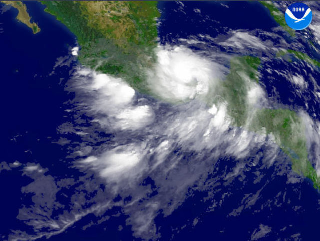
| Description |
A recent report from The National Hurricane Centre said that Hurricane Stan was located east-southeast of Veracruz, Mexico. This system was moving southwest near 10 MPH. Maximum sustained winds were near 80 MPH, with higher gusts. Centerpoint Latitude: 18:30:28N Longitude: 94:39:21W. Observation Device: GOES-12 4 km infrared imagery. |
|||
|---|---|---|---|---|
| Source |
http://www.nnvl.noaa.gov/cgi-bin/index.cgi?page=items&ser=109833 |
|||
| Date |
2005-10-04 |
|||
| Author |
NOAA Satellite and Information Service |
|||
| Permission ( Reusing this image) |
|


File history
Click on a date/time to view the file as it appeared at that time.
| Date/Time | Dimensions | User | Comment | |
|---|---|---|---|---|
| current | 20:00, 10 October 2005 | 642×482 (59 KB) | Fulfillment | ({{PD-USGov-NOAA}}) |
File links
The following pages on Schools Wikipedia link to this image (list may be incomplete):