Image:DG Ariel Plantation.jpg
From Wikipedia, the free encyclopedia

Size of this preview: 600 × 480 pixels
Full resolution (1,500 × 1,200 pixels, file size: 162 KB, MIME type: image/jpeg)
Summary
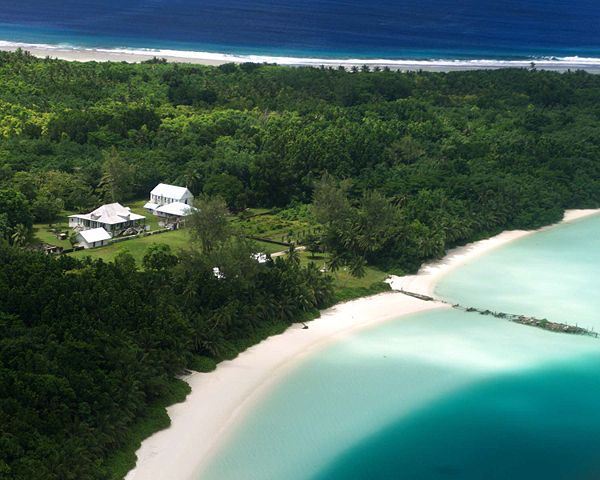
Aerial photograph of the coconut plantation at East Point, Diego Garcia. Photograph shows strip of land between both ocean and lagoon.
The island hosts a large airstrip used by the U.S. Armed forces during the Gulf war for operating B-52s. U.S. Submarines and Navy Seal teams have also populated the island in the past. In 1986 The USS Saratoga (CV 60) was docked at the island when it was called away to respond to threats by Lybian Leader Momar Kadaffi and the "Line of Death" in the Gulf of Sidra (also known as the Gulf of Sirte). The carrier left its port while many of its ±4500 sailors were still on the island, which subsequently had to be airlifted via helicopter as the ship made its way to the Mediterranean. The Saratoga spearheaded the assault on the African Nation.
Licensing
File history
Click on a date/time to view the file as it appeared at that time.
| Date/Time | Dimensions | User | Comment | |
|---|---|---|---|---|
| current | 07:37, 27 December 2005 | 1,500×1,200 (162 KB) | Jgrimmer ( Talk | contribs) | (Ariel photograph of the coconut plantation at East Point, Diego Garcia. Photograph shows stip of land between both ocean and lagoon.) |
See the setup instructions for more information.
File links
The following file is a duplicate of this file:
Metadata
This file contains additional information, probably added from the digital camera or scanner used to create or digitize it. If the file has been modified from its original state, some details may not fully reflect the modified file.
| Camera manufacturer | Kodak |
|---|---|
| Orientation | Normal |
| Horizontal resolution | 300 dpi |
| Vertical resolution | 300 dpi |
| Software used | Adobe Photoshop CS Windows |
| File change date and time | 07:22, 1 March 2005 |
| Colour space | sRGB |

