Image:Pinatubo evacuation areas.gif
From Wikipedia, the free encyclopedia
Size of this preview: 640 × 460 pixels
Full resolution (1,000 × 719 pixels, file size: 95 KB, MIME type: image/gif)
| |
This is a file from the Wikimedia Commons. The description on its description page there is shown below. |
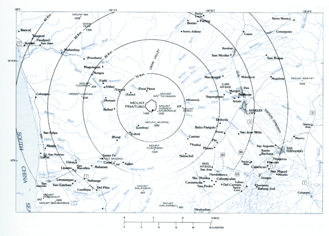
Volcanic hazard areas surrounding Mount Pinatubo.
 |
This image is in the public domain because it contains materials that originally came from the United States Geological Survey, an agency of the United States Department of Interior. For more information, see the official USGS copyright policy |
|
File history
Click on a date/time to view the file as it appeared at that time.
| Date/Time | Dimensions | User | Comment | |
|---|---|---|---|---|
| current | 09:59, 8 March 2006 | 1,000×719 (95 KB) | Magalhães | (Volcanic hazard areas surrounding Mount Pinatubo. {{PD-USGov-Interior-USGS}} Category:Mount Pinatubo) |
File links
The following pages on Schools Wikipedia link to this image (list may be incomplete):