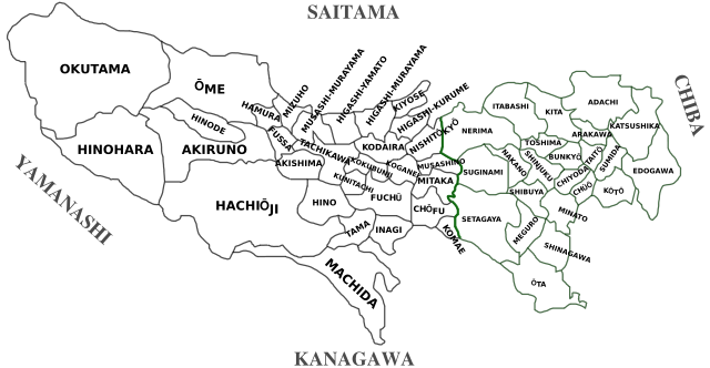
Image:TokyoMap.svg
From Wikipedia, the free encyclopedia

TokyoMap.svg (SVG file, nominally 1,013 × 525 pixels, file size: 320 KB)
File history
Click on a date/time to view the file as it appeared at that time.
| Date/Time | Dimensions | User | Comment | |
|---|---|---|---|---|
| current | 10:24, 5 August 2007 | 1,013×525 (320 KB) | Fg2 | (Intended to be the same as the previous version, except with Hachijōji changed to Hachiōji by removing the first "j" from it. Same license as previous version. User:Dzag assigned this to the public domain. {{pd-user|Dzag}}) |
| 15:55, 26 February 2007 | 1,013×525 (320 KB) | Dzag | (typo fix Hinagi -> Inagi) | |
| 15:52, 26 February 2007 | 1,013×525 (320 KB) | Dzag | (typo fix Hinagi -> Inagi) | |
| 11:07, 9 December 2006 | 1,013×525 (320 KB) | Dzag | (corr) | |
| 22:41, 8 December 2006 | 1,013×500 (320 KB) | Dzag | (cropped version) | |
| 22:23, 8 December 2006 | 1,052×744 (320 KB) | Dzag | ({{Information |Description=Tokyo Wards, Towns and Cities with rōmaji transliteration. |Source=own work, based on Image:TokyoMapCurrent.png |Date=2006-12-08 |Author= Dzag |Permission= |other_versions= }} Category:Maps of Tokyo) |
File links
The following pages on Schools Wikipedia link to this image (list may be incomplete):
