Image:Landsat krakatau 18may92 cropped.jpg
From Wikipedia, the free encyclopedia
Size of this preview: 503 × 480 pixels
Full resolution (600 × 572 pixels, file size: 41 KB, MIME type: image/jpeg)
Summary
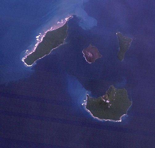
NASA Earth Observatory Landsat picture of Krakatau island area 18 May 1992 .
Licensing
 |
This work is in the public domain in the United States because it is a work of the United States Federal Government under the terms of Title 17, Chapter 1, Section 105 of the US Code. See Copyright. Note: This only applies to works of the Federal Government and not to the work of any individual U.S. state, territory, commonwealth, county, municipality, or any other subdivision. This template also does not apply to postage stamps published by the United States Postal Service after 1987. (See 206.02(b) of Compendium II: Copyright Office Practices). |
 |
| |
This file is an exact duplicate of another file from the Wikimedia Commons. Unless it is currently protected from editing, this media file may qualify for speedy deletion if it satisfies these conditions. | |
File history
Click on a date/time to view the file as it appeared at that time.
| Date/Time | Dimensions | User | Comment | |
|---|---|---|---|---|
| current | 08:07, 22 March 2007 | 600×572 (41 KB) | Anynobody ( Talk | contribs) | (NASA Earth Observatory Landsat picture of Krakatau island area 18 May 1992) |
See the setup instructions for more information.
File links
The following file is a duplicate of this file:
The following pages on Schools Wikipedia link to this image (list may be incomplete):
Categories: United States government images