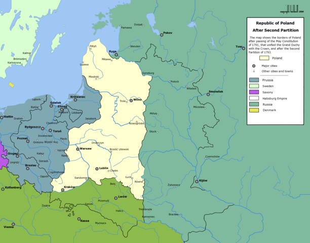
Image:Rzeczpospolita Rozbiory 2.png
From Wikipedia, the free encyclopedia

Size of this preview: 612 × 480 pixels
Full resolution (2,000 × 1,568 pixels, file size: 281 KB, MIME type: image/png)
File history
Click on a date/time to view the file as it appeared at that time.
| Date/Time | Dimensions | User | Comment | |
|---|---|---|---|---|
| current | 20:53, 16 February 2006 | 2,000×1,568 (281 KB) | Tomekpe | (Corrected mistakes: * Silesia at the time belonged to Prussia, whereas the map shows it belonging to Austria. * Sweden no longer had Estonia. * Denmark no longer had the island off the coast of Estonia. * The Ottoman Empire did not control Hungary and Mo) |
| 21:31, 25 December 2005 | 2,000×1,568 (284 KB) | Tomekpe | (Halibutt's graphic with changing polish-russian border (Krasny Horodok area). Also deleted white rectangle.) | |
| 13:41, 10 January 2005 | 2,000×1,568 (286 KB) | Halibutt | (Poland after the 2nd Partition<br>{{User:Halibutt/maps}}<br>{{User:Halibutt/GFDL}}<br> Category:Maps of Poland<br> Category:Historical maps) |
File links
The following pages on Schools Wikipedia link to this image (list may be incomplete):
Categories: Maps of the history of Poland | Maps of the history of Lithuania | Maps of the Polish-Lithuanian Commonwealth

