From Wikipedia, the free encyclopedia
 Size of this preview: 640 × 480 pixels
 Full resolution (1,944 × 1,458 pixels, file size: 641 KB, MIME type: image/jpeg)
 |
This is a file from the Wikimedia Commons. The description on its description page there is shown below.Commons is a freely licensed media file repository. You can help.
|
Summary
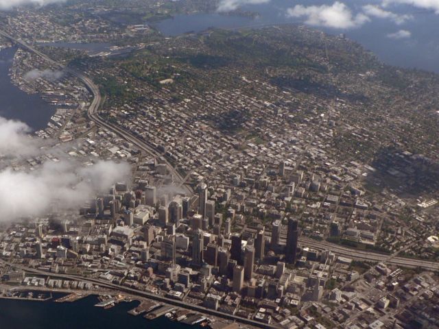
Seattle, Washington
| Description |
English: Downtown; to the left of that is South Lake Union and above that is Eastlake, the north part of Capitol Hill and Montlake; above Downtown is First Hill, the Central District, and Madison Park (and to the right of Madison Park, a bit of Madrona); Elliot Bay (foreground); Lake Union, Portage Bay, the Montlake Cut (and north of that the University District), Union Bay and Lake Washington (left to right at top) ( Seattle, Washington)
|
| Source |
Own work |
| Date |
2006.05.09T10:49:11-7.00 |
| Author |
Walter Siegmund |
Permission
( Reusing this image) |
See below
|
| Camera location |
47.599218° N, 122.35611° W 47.599218;-122.35611 |
See this image at its location on Google Maps This location on: Live Maps - Trails.com - TerraServer-USA |
- Viewpoint location: Flight 334 from Seattle/Tacoma, WA to Oakland, CA Alaska Airlines
- Viewpoint elevation: ~700 m
- View direction: Northeast
- Camera: Panasonic Lumix DMC FZ5
- Photographer: Walter Siegmund
©2006 Walter Siegmund
Licensing
File history
Click on a date/time to view the file as it appeared at that time.
|
|
Date/Time |
Dimensions |
User |
Comment |
| current |
20:25, 17 September 2006 |
1,944×1,458 (641 KB) |
Wsiegmund |
|
|
|
19:50, 17 September 2006 |
2,560×1,920 (1.98 MB) |
Wsiegmund |
|
File links
The following pages on Schools Wikipedia link to this image (list may be incomplete):

